You are here: Home > Network List > IU - Global Seismograph Network (GSN - IRIS/USGS) Stations List
> Station CCM Cathedral Cave, Missouri, USA > Earthquake Result Viewer
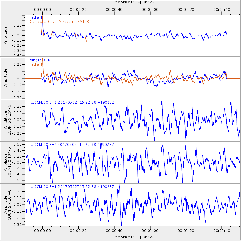
CCM Cathedral Cave, Missouri, USA - Earthquake Result Viewer
*The percent match for this event was below the threshold and hence no stack was calculated.
| Earthquake location: |
Ascension Island Region |
| Earthquake latitude/longitude: |
-11.7/-13.9 |
| Earthquake time(UTC): |
2017/05/02 (122) 15:10:22 GMT |
| Earthquake Depth: |
10 km |
| Earthquake Magnitude: |
5.6 mb |
| Earthquake Catalog/Contributor: |
NEIC PDE/us |
|
| Network: |
IU Global Seismograph Network (GSN - IRIS/USGS) |
| Station: |
CCM Cathedral Cave, Missouri, USA |
| Lat/Lon: |
38.06 N/91.24 W |
| Elevation: |
222 m |
|
| Distance: |
87.4 deg |
| Az: |
309.556 deg |
| Baz: |
106.95 deg |
| Ray Param: |
$rayparam |
*The percent match for this event was below the threshold and hence was not used in the summary stack. |
|
| Radial Match: |
55.94794 % |
| Radial Bump: |
400 |
| Transverse Match: |
36.708977 % |
| Transverse Bump: |
400 |
| SOD ConfigId: |
2028011 |
| Insert Time: |
2017-05-16 15:15:21.712 +0000 |
| GWidth: |
2.5 |
| Max Bumps: |
400 |
| Tol: |
0.001 |
|
Signal To Noise
| Channel | StoN | STA | LTA |
| IU:CCM:00:BHZ:20170502T15:22:38.419023Z | 2.5899475 | 2.637191E-7 | 1.01824114E-7 |
| IU:CCM:00:BH1:20170502T15:22:38.419023Z | 0.6842988 | 8.615985E-8 | 1.2590968E-7 |
| IU:CCM:00:BH2:20170502T15:22:38.419023Z | 1.2550704 | 1.1427561E-7 | 9.1051156E-8 |
| Arrivals |
| Ps | |
| PpPs | |
| PsPs/PpSs | |


