You are here: Home > Network List > US - United States National Seismic Network Stations List
> Station WMOK Wichita Mountains, Oklahoma, USA > Earthquake Result Viewer
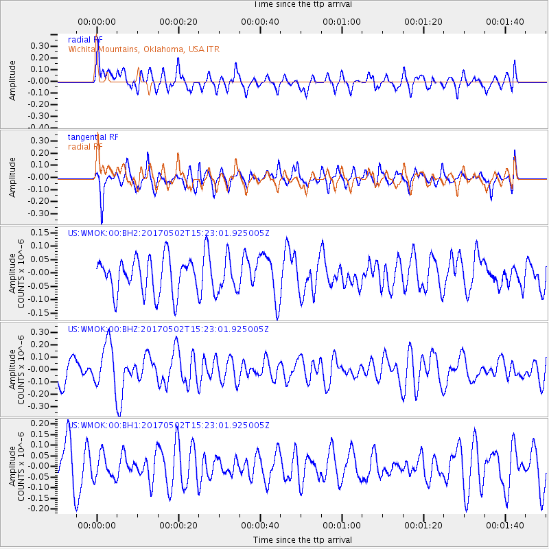
WMOK Wichita Mountains, Oklahoma, USA - Earthquake Result Viewer
*The percent match for this event was below the threshold and hence no stack was calculated.
| Earthquake location: |
Ascension Island Region |
| Earthquake latitude/longitude: |
-11.7/-13.9 |
| Earthquake time(UTC): |
2017/05/02 (122) 15:10:22 GMT |
| Earthquake Depth: |
10 km |
| Earthquake Magnitude: |
5.6 mb |
| Earthquake Catalog/Contributor: |
NEIC PDE/us |
|
| Network: |
US United States National Seismic Network |
| Station: |
WMOK Wichita Mountains, Oklahoma, USA |
| Lat/Lon: |
34.74 N/98.78 W |
| Elevation: |
486 m |
|
| Distance: |
92.4 deg |
| Az: |
304.816 deg |
| Baz: |
102.484 deg |
| Ray Param: |
$rayparam |
*The percent match for this event was below the threshold and hence was not used in the summary stack. |
|
| Radial Match: |
53.367573 % |
| Radial Bump: |
400 |
| Transverse Match: |
59.526165 % |
| Transverse Bump: |
400 |
| SOD ConfigId: |
2028011 |
| Insert Time: |
2017-05-16 15:16:40.521 +0000 |
| GWidth: |
2.5 |
| Max Bumps: |
400 |
| Tol: |
0.001 |
|
Signal To Noise
| Channel | StoN | STA | LTA |
| US:WMOK:00:BHZ:20170502T15:23:01.925005Z | 2.1523678 | 1.8374831E-7 | 8.537031E-8 |
| US:WMOK:00:BH1:20170502T15:23:01.925005Z | 0.67100126 | 5.8084154E-8 | 8.6563404E-8 |
| US:WMOK:00:BH2:20170502T15:23:01.925005Z | 0.9598909 | 6.261676E-8 | 6.523321E-8 |
| Arrivals |
| Ps | |
| PpPs | |
| PsPs/PpSs | |


