You are here: Home > Network List > TS - TERRAscope (Southern California Seismic Network) Stations List
> Station PFO Pinon Flat, California, USA > Earthquake Result Viewer
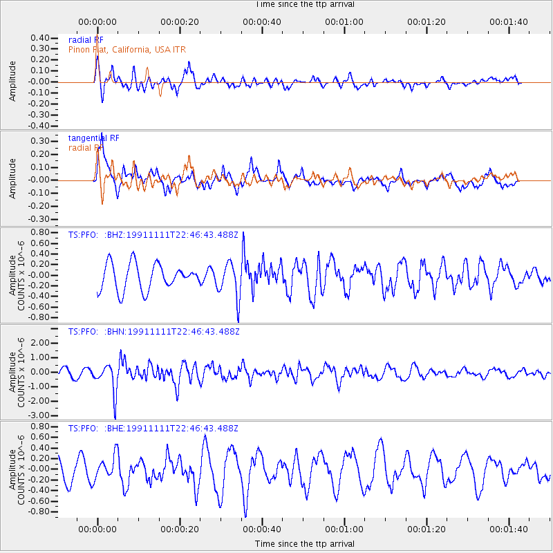
PFO Pinon Flat, California, USA - Earthquake Result Viewer
*The percent match for this event was below the threshold and hence no stack was calculated.
| Earthquake location: |
Volcano Islands, Japan Region |
| Earthquake latitude/longitude: |
24.7/142.5 |
| Earthquake time(UTC): |
1991/11/11 (315) 22:34:40 GMT |
| Earthquake Depth: |
23 km |
| Earthquake Magnitude: |
5.9 MB, 5.9 MS |
| Earthquake Catalog/Contributor: |
WHDF/NEIC |
|
| Network: |
TS TERRAscope (Southern California Seismic Network) |
| Station: |
PFO Pinon Flat, California, USA |
| Lat/Lon: |
33.61 N/116.46 W |
| Elevation: |
1280 m |
|
| Distance: |
85.2 deg |
| Az: |
55.3 deg |
| Baz: |
296.365 deg |
| Ray Param: |
$rayparam |
*The percent match for this event was below the threshold and hence was not used in the summary stack. |
|
| Radial Match: |
56.51521 % |
| Radial Bump: |
400 |
| Transverse Match: |
77.19537 % |
| Transverse Bump: |
400 |
| SOD ConfigId: |
4480 |
| Insert Time: |
2010-02-26 14:43:41.966 +0000 |
| GWidth: |
2.5 |
| Max Bumps: |
400 |
| Tol: |
0.001 |
|
Signal To Noise
| Channel | StoN | STA | LTA |
| TS:PFO: :BHN:19911111T22:46:43.488Z | 4.3292947 | 1.005624E-6 | 2.3228355E-7 |
| TS:PFO: :BHE:19911111T22:46:43.488Z | 1.7389957 | 2.2430568E-7 | 1.2898576E-7 |
| TS:PFO: :BHZ:19911111T22:46:43.488Z | 1.3715152 | 3.3487476E-7 | 2.4416408E-7 |
| Arrivals |
| Ps | |
| PpPs | |
| PsPs/PpSs | |


