You are here: Home > Network List > TA - USArray Transportable Network (new EarthScope stations) Stations List
> Station I17K Unalakleet, AK, USA > Earthquake Result Viewer
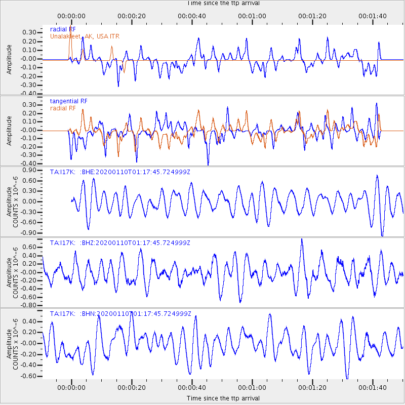
I17K Unalakleet, AK, USA - Earthquake Result Viewer
*The percent match for this event was below the threshold and hence no stack was calculated.
| Earthquake location: |
Tonga Islands |
| Earthquake latitude/longitude: |
-21.6/-175.2 |
| Earthquake time(UTC): |
2020/01/10 (010) 01:05:37 GMT |
| Earthquake Depth: |
10 km |
| Earthquake Magnitude: |
5.3 Mww |
| Earthquake Catalog/Contributor: |
NEIC PDE/us |
|
| Network: |
TA USArray Transportable Network (new EarthScope stations) |
| Station: |
I17K Unalakleet, AK, USA |
| Lat/Lon: |
63.89 N/160.70 W |
| Elevation: |
105 m |
|
| Distance: |
85.9 deg |
| Az: |
6.373 deg |
| Baz: |
193.504 deg |
| Ray Param: |
$rayparam |
*The percent match for this event was below the threshold and hence was not used in the summary stack. |
|
| Radial Match: |
43.72293 % |
| Radial Bump: |
400 |
| Transverse Match: |
49.944935 % |
| Transverse Bump: |
400 |
| SOD ConfigId: |
20906531 |
| Insert Time: |
2020-04-07 22:36:26.280 +0000 |
| GWidth: |
2.5 |
| Max Bumps: |
400 |
| Tol: |
0.001 |
|
Signal To Noise
| Channel | StoN | STA | LTA |
| TA:I17K: :BHZ:20200110T01:17:45.724999Z | 1.2431756 | 2.5752627E-7 | 2.0715197E-7 |
| TA:I17K: :BHN:20200110T01:17:45.724999Z | 1.0702864 | 2.8617944E-7 | 2.6738587E-7 |
| TA:I17K: :BHE:20200110T01:17:45.724999Z | 0.89150506 | 2.7696657E-7 | 3.1067302E-7 |
| Arrivals |
| Ps | |
| PpPs | |
| PsPs/PpSs | |


