You are here: Home > Network List > TS - TERRAscope (Southern California Seismic Network) Stations List
> Station PFO Pinon Flat, California, USA > Earthquake Result Viewer
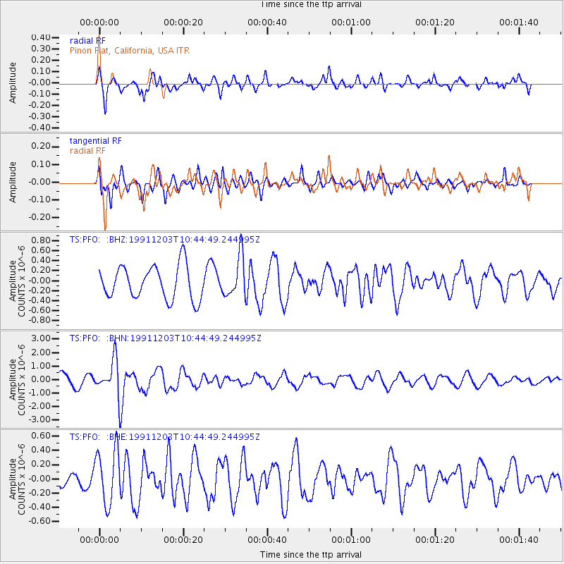
PFO Pinon Flat, California, USA - Earthquake Result Viewer
*The percent match for this event was below the threshold and hence no stack was calculated.
| Earthquake location: |
South Of Fiji Islands |
| Earthquake latitude/longitude: |
-26.3/178.6 |
| Earthquake time(UTC): |
1991/12/03 (337) 10:33:42 GMT |
| Earthquake Depth: |
581 km |
| Earthquake Magnitude: |
5.8 MB |
| Earthquake Catalog/Contributor: |
WHDF/NEIC |
|
| Network: |
TS TERRAscope (Southern California Seismic Network) |
| Station: |
PFO Pinon Flat, California, USA |
| Lat/Lon: |
33.61 N/116.46 W |
| Elevation: |
1280 m |
|
| Distance: |
85.8 deg |
| Az: |
49.313 deg |
| Baz: |
234.641 deg |
| Ray Param: |
$rayparam |
*The percent match for this event was below the threshold and hence was not used in the summary stack. |
|
| Radial Match: |
65.362976 % |
| Radial Bump: |
378 |
| Transverse Match: |
53.36957 % |
| Transverse Bump: |
400 |
| SOD ConfigId: |
4480 |
| Insert Time: |
2010-02-26 14:43:43.943 +0000 |
| GWidth: |
2.5 |
| Max Bumps: |
400 |
| Tol: |
0.001 |
|
Signal To Noise
| Channel | StoN | STA | LTA |
| TS:PFO: :BHN:19911203T10:44:49.244995Z | 2.5109444 | 1.3518619E-6 | 5.3838784E-7 |
| TS:PFO: :BHE:19911203T10:44:49.244995Z | 2.385333 | 3.8980392E-7 | 1.6341698E-7 |
| TS:PFO: :BHZ:19911203T10:44:49.244995Z | 1.2404763 | 4.099752E-7 | 3.3049824E-7 |
| Arrivals |
| Ps | |
| PpPs | |
| PsPs/PpSs | |


