You are here: Home > Network List > IW - Intermountain West Stations List
> Station MOOW Moose Ponds, Wyoming, USA > Earthquake Result Viewer
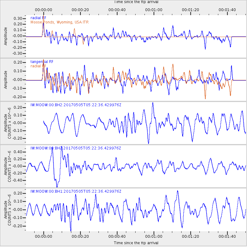
MOOW Moose Ponds, Wyoming, USA - Earthquake Result Viewer
*The percent match for this event was below the threshold and hence no stack was calculated.
| Earthquake location: |
Tajikistan |
| Earthquake latitude/longitude: |
39.5/71.4 |
| Earthquake time(UTC): |
2017/05/05 (125) 05:09:35 GMT |
| Earthquake Depth: |
10 km |
| Earthquake Magnitude: |
5.8 Mww |
| Earthquake Catalog/Contributor: |
NEIC PDE/us |
|
| Network: |
IW Intermountain West |
| Station: |
MOOW Moose Ponds, Wyoming, USA |
| Lat/Lon: |
43.75 N/110.74 W |
| Elevation: |
2128 m |
|
| Distance: |
97.1 deg |
| Az: |
1.598 deg |
| Baz: |
358.293 deg |
| Ray Param: |
$rayparam |
*The percent match for this event was below the threshold and hence was not used in the summary stack. |
|
| Radial Match: |
47.386616 % |
| Radial Bump: |
400 |
| Transverse Match: |
60.536522 % |
| Transverse Bump: |
400 |
| SOD ConfigId: |
2028011 |
| Insert Time: |
2017-05-19 05:19:05.543 +0000 |
| GWidth: |
2.5 |
| Max Bumps: |
400 |
| Tol: |
0.001 |
|
Signal To Noise
| Channel | StoN | STA | LTA |
| IW:MOOW:00:BHZ:20170505T05:22:36.429976Z | 2.5772376 | 2.068888E-7 | 8.0275406E-8 |
| IW:MOOW:00:BH1:20170505T05:22:36.429976Z | 0.66880924 | 4.2788677E-8 | 6.39774E-8 |
| IW:MOOW:00:BH2:20170505T05:22:36.429976Z | 0.612906 | 4.9788685E-8 | 8.123381E-8 |
| Arrivals |
| Ps | |
| PpPs | |
| PsPs/PpSs | |


