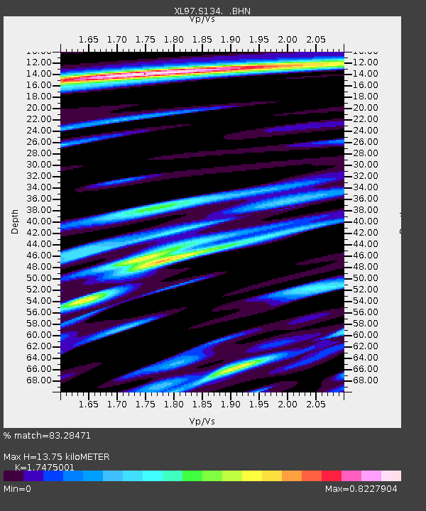
S134 Spink Canyon - Earthquake Result Viewer
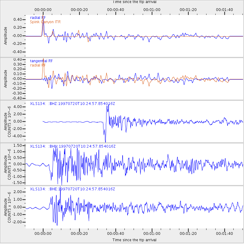
Earthquake location: Jujuy Province, Argentina
Earthquake latitude/longitude: -23.0/-66.3
Earthquake time(UTC): 1997/07/20 (201) 10:14:22 GMT
Earthquake Depth: 256 km
Earthquake Magnitude: 5.7 MB, 6.1 UNKNOWN, 5.7 ME
Earthquake Catalog/Contributor: WHDF/NEIC
Network: XL Deep Probe (Archean-Proterozoic)
Station: S134 Spink Canyon
Lat/Lon: 39.49 N/108.77 W
Elevation: 1811 m
Distance: 73.7 deg
Az: 327.022 deg
Baz: 139.592 deg
Ray Param: 0.052092776
Estimated Moho Depth: 13.75 km
Estimated Crust Vp/Vs: 1.75
Assumed Crust Vp: 6.291 km/s
Estimated Crust Vs: 3.6 km/s
Estimated Crust Poisson's Ratio: 0.26
Radial Match: 83.28471 %
Radial Bump: 400
Transverse Match: 77.91493 %
Transverse Bump: 400
SOD ConfigId: 6273
Insert Time: 2010-03-08 18:12:22.022 +0000
GWidth: 2.5
Max Bumps: 400
Tol: 0.001

Signal To Noise

ChannelStoNSTALTA
XL:S134: :BHN:19970720T10:24:57.854016Z6.0938673.968831E-76.512828E-8
XL:S134: :BHE:19970720T10:24:57.854016Z3.13477663.7788845E-71.2054717E-7
XL:S134: :BHZ:19970720T10:24:57.854016Z26.6351321.792151E-66.728523E-8
Arrivals
Ps1.7 SECOND
PpPs5.8 SECOND
PsPs/PpSs7.5 SECOND