You are here: Home > Network List > HV - Hawaiian Volcano Observatory Network Stations List
> Station MLOD Mauna Loa, Hawaii Digital > Earthquake Result Viewer
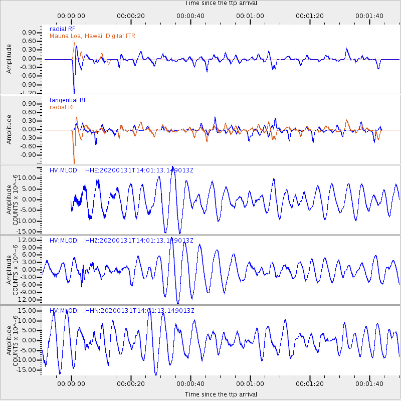
MLOD Mauna Loa, Hawaii Digital - Earthquake Result Viewer
*The percent match for this event was below the threshold and hence no stack was calculated.
| Earthquake location: |
South Of Fiji Islands |
| Earthquake latitude/longitude: |
-25.4/178.5 |
| Earthquake time(UTC): |
2020/01/31 (031) 13:53:30 GMT |
| Earthquake Depth: |
576 km |
| Earthquake Magnitude: |
5.7 mww |
| Earthquake Catalog/Contributor: |
NEIC PDE/us |
|
| Network: |
HV Hawaiian Volcano Observatory Network |
| Station: |
MLOD Mauna Loa, Hawaii Digital |
| Lat/Lon: |
19.49 N/155.39 W |
| Elevation: |
2044 m |
|
| Distance: |
51.3 deg |
| Az: |
32.145 deg |
| Baz: |
210.682 deg |
| Ray Param: |
$rayparam |
*The percent match for this event was below the threshold and hence was not used in the summary stack. |
|
| Radial Match: |
45.225548 % |
| Radial Bump: |
400 |
| Transverse Match: |
56.726345 % |
| Transverse Bump: |
309 |
| SOD ConfigId: |
20906531 |
| Insert Time: |
2020-04-08 04:18:30.467 +0000 |
| GWidth: |
2.5 |
| Max Bumps: |
400 |
| Tol: |
0.001 |
|
Signal To Noise
| Channel | StoN | STA | LTA |
| HV:MLOD: :HHZ:20200131T14:01:13.149013Z | 0.82855695 | 3.1853472E-6 | 3.844452E-6 |
| HV:MLOD: :HHN:20200131T14:01:13.149013Z | 0.8961741 | 7.0625356E-6 | 7.880763E-6 |
| HV:MLOD: :HHE:20200131T14:01:13.149013Z | 1.8173034 | 8.910099E-6 | 4.902923E-6 |
| Arrivals |
| Ps | |
| PpPs | |
| PsPs/PpSs | |


