You are here: Home > Network List > US - United States National Seismic Network Stations List
> Station DGMT Dagmar, Montana, USA > Earthquake Result Viewer
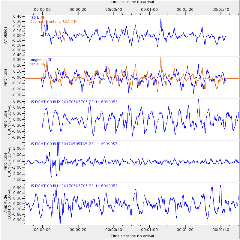
DGMT Dagmar, Montana, USA - Earthquake Result Viewer
*The percent match for this event was below the threshold and hence no stack was calculated.
| Earthquake location: |
Tajikistan |
| Earthquake latitude/longitude: |
39.5/71.4 |
| Earthquake time(UTC): |
2017/05/05 (125) 05:09:35 GMT |
| Earthquake Depth: |
10 km |
| Earthquake Magnitude: |
5.8 Mww |
| Earthquake Catalog/Contributor: |
NEIC PDE/us |
|
| Network: |
US United States National Seismic Network |
| Station: |
DGMT Dagmar, Montana, USA |
| Lat/Lon: |
48.47 N/104.20 W |
| Elevation: |
0.0 m |
|
| Distance: |
92.3 deg |
| Az: |
357.097 deg |
| Baz: |
3.377 deg |
| Ray Param: |
$rayparam |
*The percent match for this event was below the threshold and hence was not used in the summary stack. |
|
| Radial Match: |
73.40852 % |
| Radial Bump: |
330 |
| Transverse Match: |
60.488808 % |
| Transverse Bump: |
319 |
| SOD ConfigId: |
2028011 |
| Insert Time: |
2017-05-19 05:19:54.217 +0000 |
| GWidth: |
2.5 |
| Max Bumps: |
400 |
| Tol: |
0.001 |
|
Signal To Noise
| Channel | StoN | STA | LTA |
| US:DGMT:00:BHZ:20170505T05:22:14.699995Z | 5.5462637 | 6.787658E-7 | 1.2238253E-7 |
| US:DGMT:00:BH1:20170505T05:22:14.699995Z | 1.5666198 | 3.7108518E-7 | 2.3686998E-7 |
| US:DGMT:00:BH2:20170505T05:22:14.699995Z | 0.92069423 | 2.6585764E-7 | 2.887578E-7 |
| Arrivals |
| Ps | |
| PpPs | |
| PsPs/PpSs | |


