You are here: Home > Network List > TS - TERRAscope (Southern California Seismic Network) Stations List
> Station PFO Pinon Flat, California, USA > Earthquake Result Viewer
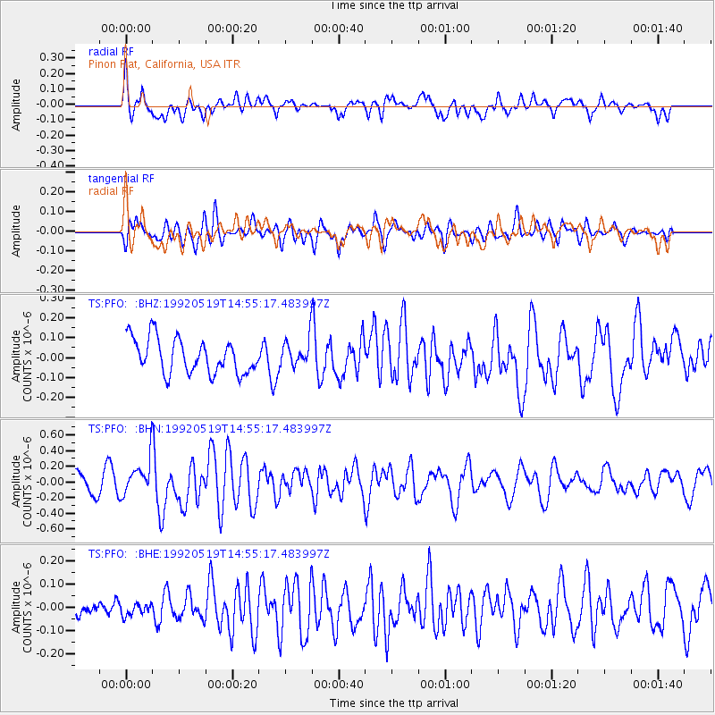
PFO Pinon Flat, California, USA - Earthquake Result Viewer
*The percent match for this event was below the threshold and hence no stack was calculated.
| Earthquake location: |
Solomon Islands |
| Earthquake latitude/longitude: |
-9.4/159.3 |
| Earthquake time(UTC): |
1992/05/19 (140) 14:42:50 GMT |
| Earthquake Depth: |
33 km |
| Earthquake Magnitude: |
5.5 MB, 5.6 MS |
| Earthquake Catalog/Contributor: |
WHDF/NEIC |
|
| Network: |
TS TERRAscope (Southern California Seismic Network) |
| Station: |
PFO Pinon Flat, California, USA |
| Lat/Lon: |
33.61 N/116.46 W |
| Elevation: |
1280 m |
|
| Distance: |
90.4 deg |
| Az: |
56.135 deg |
| Baz: |
259.024 deg |
| Ray Param: |
$rayparam |
*The percent match for this event was below the threshold and hence was not used in the summary stack. |
|
| Radial Match: |
56.696514 % |
| Radial Bump: |
400 |
| Transverse Match: |
65.47491 % |
| Transverse Bump: |
400 |
| SOD ConfigId: |
4480 |
| Insert Time: |
2010-02-26 14:43:49.973 +0000 |
| GWidth: |
2.5 |
| Max Bumps: |
400 |
| Tol: |
0.001 |
|
Signal To Noise
| Channel | StoN | STA | LTA |
| TS:PFO: :BHN:19920519T14:55:17.483997Z | 2.1121066 | 2.395254E-7 | 1.1340593E-7 |
| TS:PFO: :BHE:19920519T14:55:17.483997Z | 0.40368545 | 2.508412E-8 | 6.213779E-8 |
| TS:PFO: :BHZ:19920519T14:55:17.483997Z | 0.78604335 | 6.816326E-8 | 8.671692E-8 |
| Arrivals |
| Ps | |
| PpPs | |
| PsPs/PpSs | |


