You are here: Home > Network List > UW - Pacific Northwest Regional Seismic Network Stations List
> Station IRON Crane, OR, USA > Earthquake Result Viewer
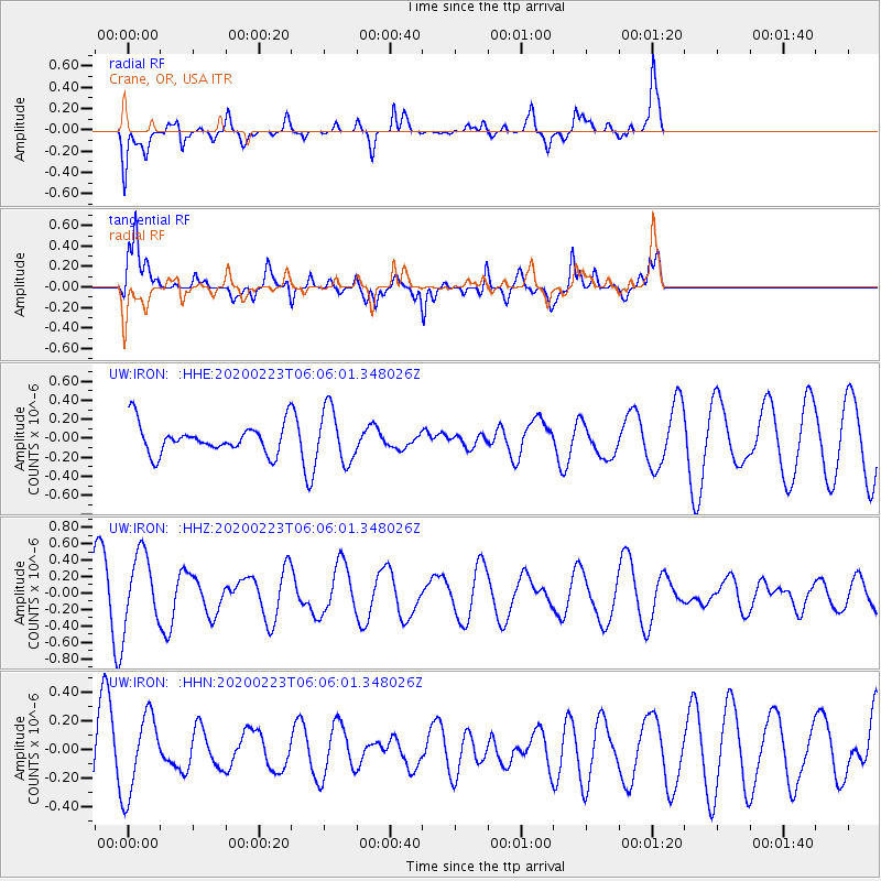
IRON Crane, OR, USA - Earthquake Result Viewer
*The percent match for this event was below the threshold and hence no stack was calculated.
| Earthquake location: |
Turkey-Iran Border Region |
| Earthquake latitude/longitude: |
38.5/44.4 |
| Earthquake time(UTC): |
2020/02/23 (054) 05:53:01 GMT |
| Earthquake Depth: |
6.4 km |
| Earthquake Magnitude: |
5.7 mww |
| Earthquake Catalog/Contributor: |
NEIC PDE/us |
|
| Network: |
UW Pacific Northwest Regional Seismic Network |
| Station: |
IRON Crane, OR, USA |
| Lat/Lon: |
43.36 N/118.47 W |
| Elevation: |
1226 m |
|
| Distance: |
97.1 deg |
| Az: |
347.505 deg |
| Baz: |
13.458 deg |
| Ray Param: |
$rayparam |
*The percent match for this event was below the threshold and hence was not used in the summary stack. |
|
| Radial Match: |
55.26961 % |
| Radial Bump: |
391 |
| Transverse Match: |
74.47783 % |
| Transverse Bump: |
400 |
| SOD ConfigId: |
20906531 |
| Insert Time: |
2020-04-08 07:32:07.233 +0000 |
| GWidth: |
2.5 |
| Max Bumps: |
400 |
| Tol: |
0.001 |
|
Signal To Noise
| Channel | StoN | STA | LTA |
| UW:IRON: :HHZ:20200223T06:06:01.348026Z | 1.6710086 | 4.3440633E-7 | 2.5996655E-7 |
| UW:IRON: :HHN:20200223T06:06:01.348026Z | 0.8970539 | 2.7061276E-7 | 3.0166834E-7 |
| UW:IRON: :HHE:20200223T06:06:01.348026Z | 1.7896186 | 2.793653E-7 | 1.5610327E-7 |
| Arrivals |
| Ps | |
| PpPs | |
| PsPs/PpSs | |


