You are here: Home > Network List > G - GEOSCOPE Stations List
> Station MPG Montagne des Peres, French Guyana > Earthquake Result Viewer
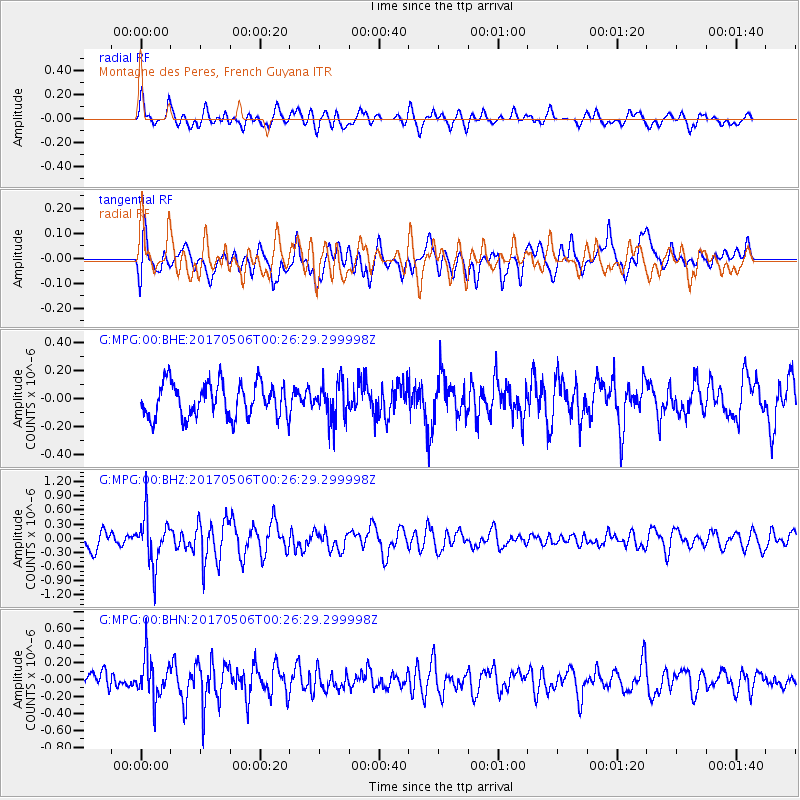
MPG Montagne des Peres, French Guyana - Earthquake Result Viewer
*The percent match for this event was below the threshold and hence no stack was calculated.
| Earthquake location: |
Scotia Sea |
| Earthquake latitude/longitude: |
-60.8/-37.9 |
| Earthquake time(UTC): |
2017/05/06 (126) 00:16:09 GMT |
| Earthquake Depth: |
10 km |
| Earthquake Magnitude: |
5.7 mb |
| Earthquake Catalog/Contributor: |
NEIC PDE/us |
|
| Network: |
G GEOSCOPE |
| Station: |
MPG Montagne des Peres, French Guyana |
| Lat/Lon: |
5.11 N/52.64 W |
| Elevation: |
147 m |
|
| Distance: |
66.7 deg |
| Az: |
343.932 deg |
| Baz: |
172.172 deg |
| Ray Param: |
$rayparam |
*The percent match for this event was below the threshold and hence was not used in the summary stack. |
|
| Radial Match: |
65.1643 % |
| Radial Bump: |
400 |
| Transverse Match: |
60.67282 % |
| Transverse Bump: |
400 |
| SOD ConfigId: |
2028011 |
| Insert Time: |
2017-05-20 00:24:00.964 +0000 |
| GWidth: |
2.5 |
| Max Bumps: |
400 |
| Tol: |
0.001 |
|
Signal To Noise
| Channel | StoN | STA | LTA |
| G:MPG:00:BHZ:20170506T00:26:29.299998Z | 2.700382 | 5.0392856E-7 | 1.8661382E-7 |
| G:MPG:00:BHN:20170506T00:26:29.299998Z | 1.925495 | 2.392622E-7 | 1.242601E-7 |
| G:MPG:00:BHE:20170506T00:26:29.299998Z | 1.1194979 | 1.3550303E-7 | 1.2103911E-7 |
| Arrivals |
| Ps | |
| PpPs | |
| PsPs/PpSs | |


