You are here: Home > Network List > TA - USArray Transportable Network (new EarthScope stations) Stations List
> Station Q17K Contact Creek, Katmai, AK, USA > Earthquake Result Viewer
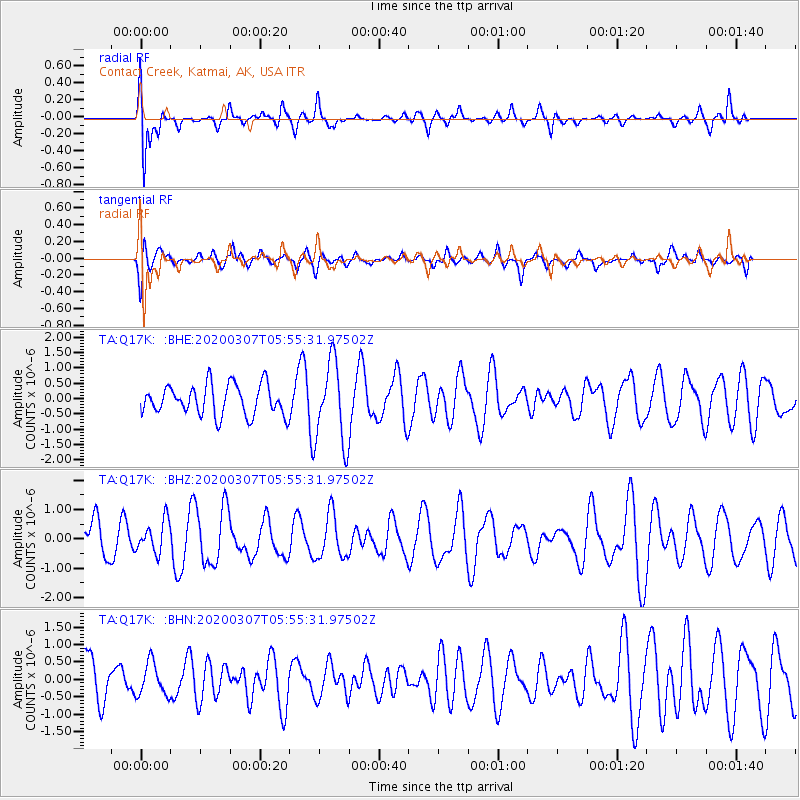
Q17K Contact Creek, Katmai, AK, USA - Earthquake Result Viewer
*The percent match for this event was below the threshold and hence no stack was calculated.
| Earthquake location: |
Vanuatu Islands |
| Earthquake latitude/longitude: |
-17.9/167.9 |
| Earthquake time(UTC): |
2020/03/07 (067) 05:43:45 GMT |
| Earthquake Depth: |
10 km |
| Earthquake Magnitude: |
5.5 Mww |
| Earthquake Catalog/Contributor: |
NEIC PDE/us |
|
| Network: |
TA USArray Transportable Network (new EarthScope stations) |
| Station: |
Q17K Contact Creek, Katmai, AK, USA |
| Lat/Lon: |
58.26 N/155.89 W |
| Elevation: |
1165 m |
|
| Distance: |
81.6 deg |
| Az: |
18.425 deg |
| Baz: |
214.708 deg |
| Ray Param: |
$rayparam |
*The percent match for this event was below the threshold and hence was not used in the summary stack. |
|
| Radial Match: |
76.34483 % |
| Radial Bump: |
400 |
| Transverse Match: |
46.55714 % |
| Transverse Bump: |
400 |
| SOD ConfigId: |
20906531 |
| Insert Time: |
2020-04-08 08:54:36.009 +0000 |
| GWidth: |
2.5 |
| Max Bumps: |
400 |
| Tol: |
0.001 |
|
Signal To Noise
| Channel | StoN | STA | LTA |
| TA:Q17K: :BHZ:20200307T05:55:31.97502Z | 0.71752334 | 5.3874203E-7 | 7.508355E-7 |
| TA:Q17K: :BHN:20200307T05:55:31.97502Z | 0.5555619 | 4.702395E-7 | 8.464215E-7 |
| TA:Q17K: :BHE:20200307T05:55:31.97502Z | 2.7215269 | 1.3512746E-6 | 4.965134E-7 |
| Arrivals |
| Ps | |
| PpPs | |
| PsPs/PpSs | |


