You are here: Home > Network List > GS - US Geological Survey Networks Stations List
> Station KAN13 Rinehart Farm > Earthquake Result Viewer
KAN13 Rinehart Farm - Earthquake Result Viewer
*The percent match for this event was below the threshold and hence no stack was calculated.
| Earthquake location: |
Off Coast Of Central Chile |
| Earthquake latitude/longitude: |
-33.2/-72.0 |
| Earthquake time(UTC): |
2017/04/28 (118) 15:58:34 GMT |
| Earthquake Depth: |
23 km |
| Earthquake Magnitude: |
5.4 Mww |
| Earthquake Catalog/Contributor: |
NEIC PDE/us |
|
| Network: |
GS US Geological Survey Networks |
| Station: |
KAN13 Rinehart Farm |
| Lat/Lon: |
37.01 N/97.48 W |
| Elevation: |
340 m |
|
| Distance: |
73.8 deg |
| Az: |
339.016 deg |
| Baz: |
157.978 deg |
| Ray Param: |
$rayparam |
*The percent match for this event was below the threshold and hence was not used in the summary stack. |
|
| Radial Match: |
55.96757 % |
| Radial Bump: |
385 |
| Transverse Match: |
66.16912 % |
| Transverse Bump: |
320 |
| SOD ConfigId: |
2028011 |
| Insert Time: |
2017-05-22 14:04:33.210 +0000 |
| GWidth: |
2.5 |
| Max Bumps: |
400 |
| Tol: |
0.001 |
|
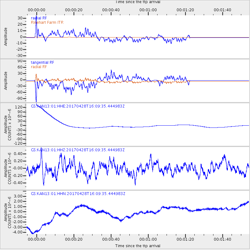
Signal To Noise
| Channel | StoN | STA | LTA |
| GS:KAN13:01:HHZ:20170428T16:09:35.444983Z | 2.3820653 | 2.3003349E-7 | 9.6568925E-8 |
| GS:KAN13:01:HHN:20170428T16:09:35.444983Z | 1.2229575 | 1.0092728E-5 | 8.252722E-6 |
| GS:KAN13:01:HHE:20170428T16:09:35.444983Z | 1.1027869 | 5.350338E-5 | 4.8516515E-5 |
| Arrivals |
| Ps | |
| PpPs | |
| PsPs/PpSs | |


