You are here: Home > Network List > TA - USArray Transportable Network (new EarthScope stations) Stations List
> Station C16K Lisburne Hills, AK, USA > Earthquake Result Viewer
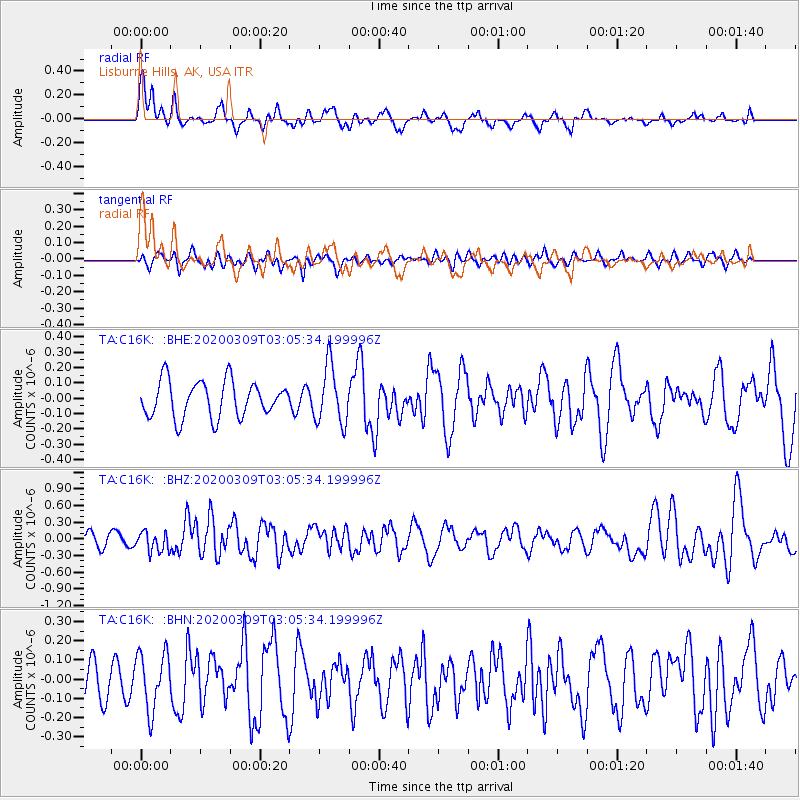
C16K Lisburne Hills, AK, USA - Earthquake Result Viewer
*The percent match for this event was below the threshold and hence no stack was calculated.
| Earthquake location: |
Off Coast Of Northern California |
| Earthquake latitude/longitude: |
40.4/-125.1 |
| Earthquake time(UTC): |
2020/03/09 (069) 02:59:08 GMT |
| Earthquake Depth: |
3.2 km |
| Earthquake Magnitude: |
5.8 Mw |
| Earthquake Catalog/Contributor: |
NEIC PDE/nc |
|
| Network: |
TA USArray Transportable Network (new EarthScope stations) |
| Station: |
C16K Lisburne Hills, AK, USA |
| Lat/Lon: |
68.27 N/165.34 W |
| Elevation: |
102 m |
|
| Distance: |
35.3 deg |
| Az: |
335.401 deg |
| Baz: |
121.356 deg |
| Ray Param: |
$rayparam |
*The percent match for this event was below the threshold and hence was not used in the summary stack. |
|
| Radial Match: |
60.90742 % |
| Radial Bump: |
400 |
| Transverse Match: |
45.79474 % |
| Transverse Bump: |
400 |
| SOD ConfigId: |
20906531 |
| Insert Time: |
2020-04-08 09:06:26.958 +0000 |
| GWidth: |
2.5 |
| Max Bumps: |
400 |
| Tol: |
0.001 |
|
Signal To Noise
| Channel | StoN | STA | LTA |
| TA:C16K: :BHZ:20200309T03:05:34.199996Z | 1.8221822 | 1.7664124E-7 | 9.6939395E-8 |
| TA:C16K: :BHN:20200309T03:05:34.199996Z | 1.9522673 | 1.4868355E-7 | 7.6159424E-8 |
| TA:C16K: :BHE:20200309T03:05:34.199996Z | 1.6032877 | 1.8771729E-7 | 1.1708273E-7 |
| Arrivals |
| Ps | |
| PpPs | |
| PsPs/PpSs | |


