
S221 Green River - Earthquake Result Viewer
| ||||||||||||||||||
| ||||||||||||||||||
| ||||||||||||||||||
|

Signal To Noise
| Channel | StoN | STA | LTA |
| XL:S221: :BHN:19971015T01:15:01.43302Z | 3.8945324 | 4.5300965E-7 | 1.1631939E-7 |
| XL:S221: :BHE:19971015T01:15:01.43302Z | 1.2453967 | 1.8184937E-7 | 1.4601723E-7 |
| XL:S221: :BHZ:19971015T01:15:01.43302Z | 14.763442 | 1.7661017E-6 | 1.1962669E-7 |
| Arrivals | |
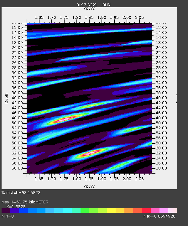
| Ps | 8.7 SECOND |
| PpPs | 28 SECOND |
| PsPs/PpSs | 36 SECOND |

