You are here: Home > Network List > CN - Canadian National Seismograph Network Stations List
> Station INK INUVIK, NT > Earthquake Result Viewer
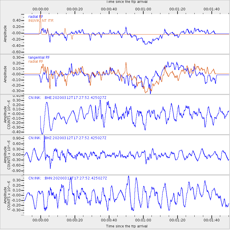
INK INUVIK, NT - Earthquake Result Viewer
*The percent match for this event was below the threshold and hence no stack was calculated.
| Earthquake location: |
Near West Coast Of Honshu, Japan |
| Earthquake latitude/longitude: |
37.3/136.9 |
| Earthquake time(UTC): |
2020/03/12 (072) 17:18:46 GMT |
| Earthquake Depth: |
10 km |
| Earthquake Magnitude: |
5.3 Mww |
| Earthquake Catalog/Contributor: |
NEIC PDE/us |
|
| Network: |
CN Canadian National Seismograph Network |
| Station: |
INK INUVIK, NT |
| Lat/Lon: |
68.31 N/133.53 W |
| Elevation: |
44 m |
|
| Distance: |
55.8 deg |
| Az: |
26.708 deg |
| Baz: |
285.352 deg |
| Ray Param: |
$rayparam |
*The percent match for this event was below the threshold and hence was not used in the summary stack. |
|
| Radial Match: |
41.92771 % |
| Radial Bump: |
400 |
| Transverse Match: |
54.87998 % |
| Transverse Bump: |
400 |
| SOD ConfigId: |
20906531 |
| Insert Time: |
2020-04-08 09:38:49.791 +0000 |
| GWidth: |
2.5 |
| Max Bumps: |
400 |
| Tol: |
0.001 |
|
Signal To Noise
| Channel | StoN | STA | LTA |
| CN:INK: :BHZ:20200312T17:27:52.425027Z | 2.0058281 | 3.125087E-7 | 1.5580035E-7 |
| CN:INK: :BHN:20200312T17:27:52.425027Z | 1.4562753 | 1.6324378E-7 | 1.12096785E-7 |
| CN:INK: :BHE:20200312T17:27:52.425027Z | 1.1381675 | 1.8032749E-7 | 1.5843668E-7 |
| Arrivals |
| Ps | |
| PpPs | |
| PsPs/PpSs | |


