S113 LP6 pipeline - Earthquake Result Viewer
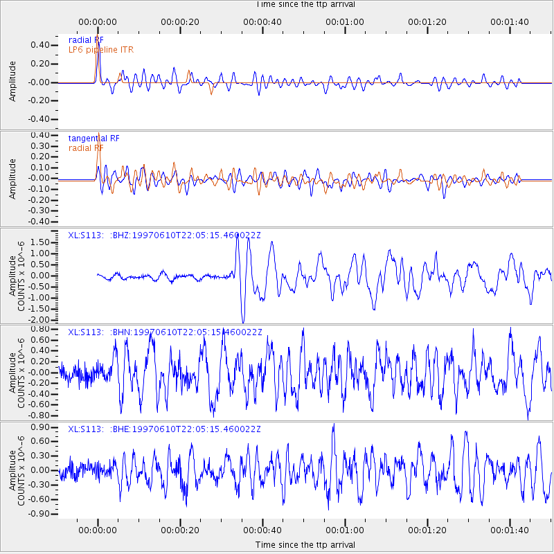
Earthquake location: Southern East Pacific Rise
Earthquake latitude/longitude: -35.8/-108.1
Earthquake time(UTC): 1997/06/10 (161) 21:53:55 GMT
Earthquake Depth: 10 km
Earthquake Magnitude: 5.8 MB, 6.1 MS, 6.5 UNKNOWN, 5.8 MS
Earthquake Catalog/Contributor: WHDF/NEIC
Network: XL Deep Probe (Archean-Proterozoic)
Station: S113 LP6 pipeline
Lat/Lon: 41.37 N/108.86 W
Elevation: 2133 m
Distance: 76.8 deg
Az: 359.438 deg
Baz: 179.393 deg
Ray Param: 0.05074248
Estimated Moho Depth: 67.75 km
Estimated Crust Vp/Vs: 1.83
Assumed Crust Vp: 6.207 km/s
Estimated Crust Vs: 3.396 km/s
Estimated Crust Poisson's Ratio: 0.29
Radial Match: 81.48923 %
Radial Bump: 400
Transverse Match: 72.21416 %
Transverse Bump: 400
SOD ConfigId: 6273
Insert Time: 2010-03-08 18:14:18.477 +0000
GWidth: 2.5
Max Bumps: 400
Tol: 0.001

Signal To Noise

ChannelStoNSTALTA
XL:S113: :BHN:19970610T22:05:15.460022Z1.36830542.224323E-71.6256043E-7
XL:S113: :BHE:19970610T22:05:15.460022Z0.72768131.1420214E-71.5693978E-7
XL:S113: :BHZ:19970610T22:05:15.460022Z6.1156016.3546145E-71.0390826E-7
Arrivals
Ps9.3 SECOND
PpPs30 SECOND
PsPs/PpSs39 SECOND