You are here: Home > Network List > TA - USArray Transportable Network (new EarthScope stations) Stations List
> Station C16K Lisburne Hills, AK, USA > Earthquake Result Viewer
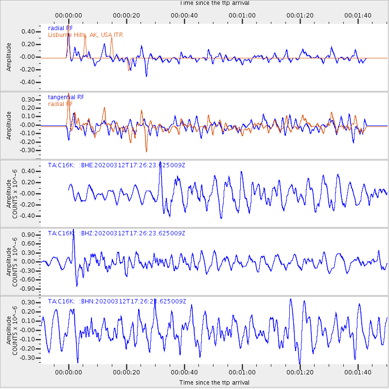
C16K Lisburne Hills, AK, USA - Earthquake Result Viewer
*The percent match for this event was below the threshold and hence no stack was calculated.
| Earthquake location: |
Near West Coast Of Honshu, Japan |
| Earthquake latitude/longitude: |
37.3/136.9 |
| Earthquake time(UTC): |
2020/03/12 (072) 17:18:46 GMT |
| Earthquake Depth: |
10 km |
| Earthquake Magnitude: |
5.3 Mww |
| Earthquake Catalog/Contributor: |
NEIC PDE/us |
|
| Network: |
TA USArray Transportable Network (new EarthScope stations) |
| Station: |
C16K Lisburne Hills, AK, USA |
| Lat/Lon: |
68.27 N/165.34 W |
| Elevation: |
102 m |
|
| Distance: |
44.1 deg |
| Az: |
26.908 deg |
| Baz: |
255.843 deg |
| Ray Param: |
$rayparam |
*The percent match for this event was below the threshold and hence was not used in the summary stack. |
|
| Radial Match: |
49.48907 % |
| Radial Bump: |
364 |
| Transverse Match: |
55.39103 % |
| Transverse Bump: |
400 |
| SOD ConfigId: |
20906531 |
| Insert Time: |
2020-04-08 09:48:53.598 +0000 |
| GWidth: |
2.5 |
| Max Bumps: |
400 |
| Tol: |
0.001 |
|
Signal To Noise
| Channel | StoN | STA | LTA |
| TA:C16K: :BHZ:20200312T17:26:23.625009Z | 2.4507222 | 3.9865873E-7 | 1.626699E-7 |
| TA:C16K: :BHN:20200312T17:26:23.625009Z | 1.572497 | 1.6358801E-7 | 1.0403073E-7 |
| TA:C16K: :BHE:20200312T17:26:23.625009Z | 2.9298687 | 2.5343883E-7 | 8.650177E-8 |
| Arrivals |
| Ps | |
| PpPs | |
| PsPs/PpSs | |


