S114 Milepost 35 - Earthquake Result Viewer
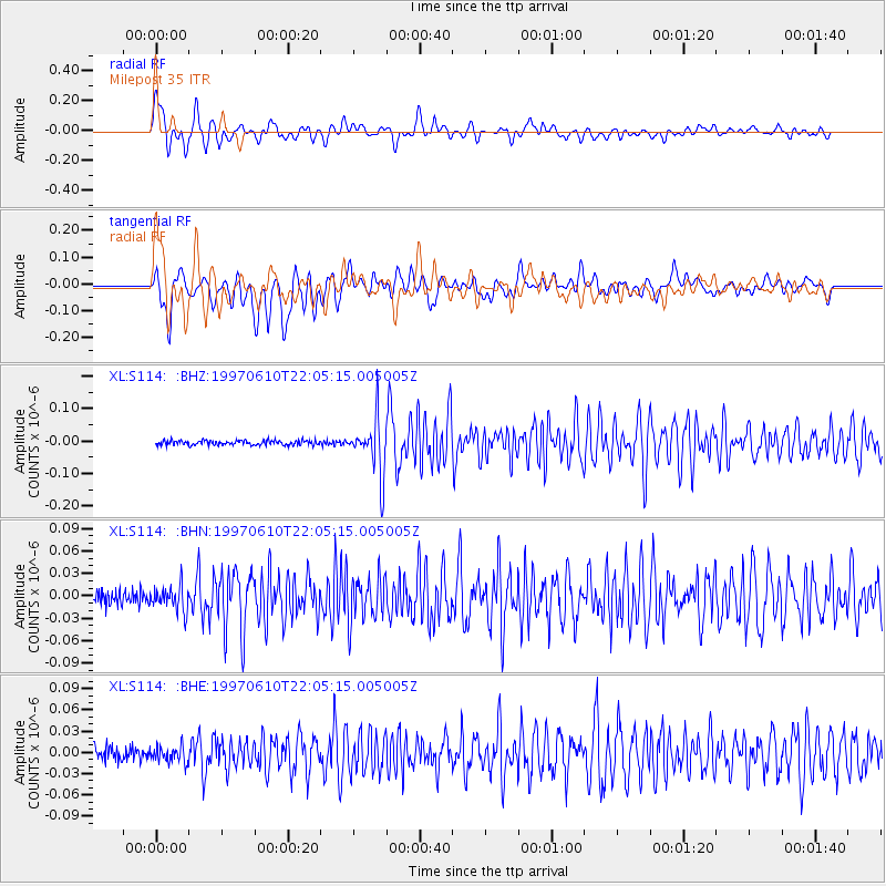
Earthquake location: Southern East Pacific Rise
Earthquake latitude/longitude: -35.8/-108.1
Earthquake time(UTC): 1997/06/10 (161) 21:53:55 GMT
Earthquake Depth: 10 km
Earthquake Magnitude: 5.8 MB, 6.1 MS, 6.5 UNKNOWN, 5.8 MS
Earthquake Catalog/Contributor: WHDF/NEIC
Network: XL Deep Probe (Archean-Proterozoic)
Station: S114 Milepost 35
Lat/Lon: 41.27 N/108.81 W
Elevation: 2124 m
Distance: 76.7 deg
Az: 359.474 deg
Baz: 179.433 deg
Ray Param: 0.050808202
Estimated Moho Depth: 37.5 km
Estimated Crust Vp/Vs: 2.00
Assumed Crust Vp: 6.207 km/s
Estimated Crust Vs: 3.103 km/s
Estimated Crust Poisson's Ratio: 0.33
Radial Match: 88.90484 %
Radial Bump: 400
Transverse Match: 80.39364 %
Transverse Bump: 400
SOD ConfigId: 6273
Insert Time: 2010-03-08 18:14:33.329 +0000
GWidth: 2.5
Max Bumps: 400
Tol: 0.001

Signal To Noise

ChannelStoNSTALTA
XL:S114: :BHN:19970610T22:05:15.005005Z1.86166881.6355063E-88.785163E-9
XL:S114: :BHE:19970610T22:05:15.005005Z1.26451371.1391438E-89.008552E-9
XL:S114: :BHZ:19970610T22:05:15.005005Z11.845668.3757165E-87.0707045E-9
Arrivals
Ps6.2 SECOND
PpPs18 SECOND
PsPs/PpSs24 SECOND