You are here: Home > Network List > GS - US Geological Survey Networks Stations List
> Station KAN13 Rinehart Farm > Earthquake Result Viewer
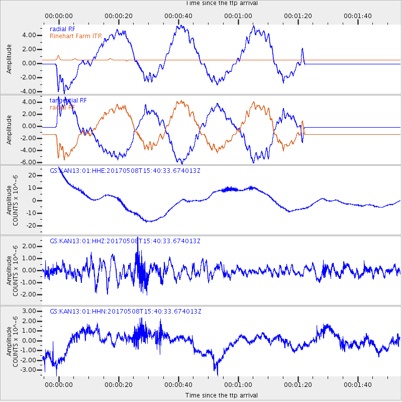
KAN13 Rinehart Farm - Earthquake Result Viewer
*The percent match for this event was below the threshold and hence no stack was calculated.
| Earthquake location: |
Andreanof Islands, Aleutian Is. |
| Earthquake latitude/longitude: |
51.1/-177.0 |
| Earthquake time(UTC): |
2017/05/08 (128) 15:31:28 GMT |
| Earthquake Depth: |
41 km |
| Earthquake Magnitude: |
5.5 Ml |
| Earthquake Catalog/Contributor: |
NEIC PDE/ak |
|
| Network: |
GS US Geological Survey Networks |
| Station: |
KAN13 Rinehart Farm |
| Lat/Lon: |
37.01 N/97.48 W |
| Elevation: |
340 m |
|
| Distance: |
56.2 deg |
| Az: |
71.363 deg |
| Baz: |
311.675 deg |
| Ray Param: |
$rayparam |
*The percent match for this event was below the threshold and hence was not used in the summary stack. |
|
| Radial Match: |
37.24005 % |
| Radial Bump: |
400 |
| Transverse Match: |
38.902657 % |
| Transverse Bump: |
400 |
| SOD ConfigId: |
2028011 |
| Insert Time: |
2017-05-22 15:34:30.074 +0000 |
| GWidth: |
2.5 |
| Max Bumps: |
400 |
| Tol: |
0.001 |
|
Signal To Noise
| Channel | StoN | STA | LTA |
| GS:KAN13:01:HHZ:20170508T15:40:33.674013Z | 1.0742556 | 3.434566E-7 | 3.197159E-7 |
| GS:KAN13:01:HHN:20170508T15:40:33.674013Z | 1.3815298 | 2.1229234E-6 | 1.5366469E-6 |
| GS:KAN13:01:HHE:20170508T15:40:33.674013Z | 2.572477 | 2.0392303E-5 | 7.927108E-6 |
| Arrivals |
| Ps | |
| PpPs | |
| PsPs/PpSs | |


