You are here: Home > Network List > TA - USArray Transportable Network (new EarthScope stations) Stations List
> Station K15K Wolf Creek Mountain, AK, USA > Earthquake Result Viewer
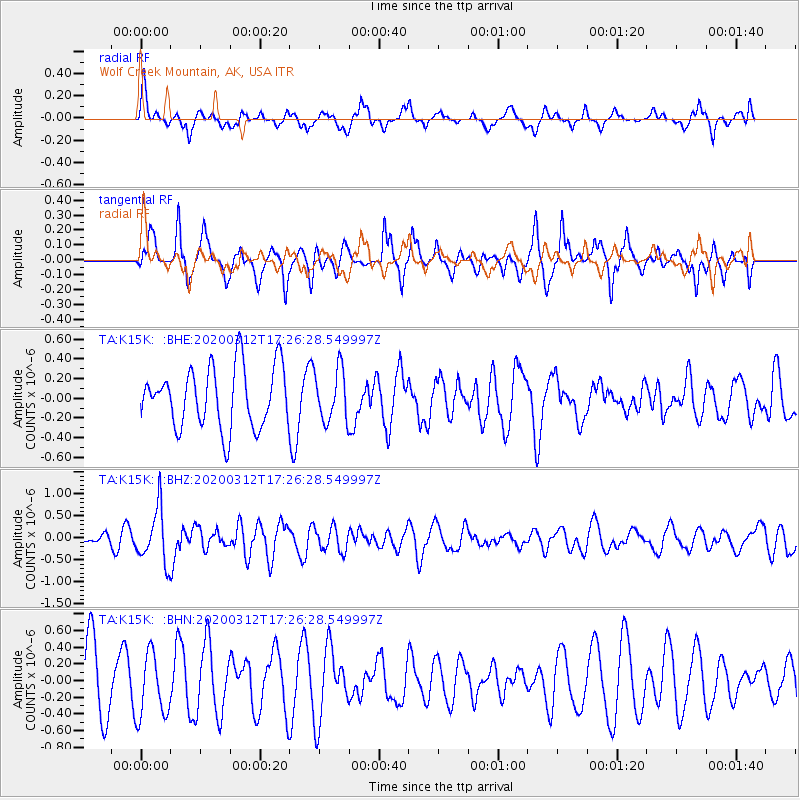
K15K Wolf Creek Mountain, AK, USA - Earthquake Result Viewer
*The percent match for this event was below the threshold and hence no stack was calculated.
| Earthquake location: |
Near West Coast Of Honshu, Japan |
| Earthquake latitude/longitude: |
37.3/136.9 |
| Earthquake time(UTC): |
2020/03/12 (072) 17:18:46 GMT |
| Earthquake Depth: |
10 km |
| Earthquake Magnitude: |
5.3 Mww |
| Earthquake Catalog/Contributor: |
NEIC PDE/us |
|
| Network: |
TA USArray Transportable Network (new EarthScope stations) |
| Station: |
K15K Wolf Creek Mountain, AK, USA |
| Lat/Lon: |
62.29 N/161.53 W |
| Elevation: |
346 m |
|
| Distance: |
44.7 deg |
| Az: |
35.748 deg |
| Baz: |
265.628 deg |
| Ray Param: |
$rayparam |
*The percent match for this event was below the threshold and hence was not used in the summary stack. |
|
| Radial Match: |
54.35848 % |
| Radial Bump: |
400 |
| Transverse Match: |
64.5833 % |
| Transverse Bump: |
387 |
| SOD ConfigId: |
20906531 |
| Insert Time: |
2020-04-08 09:50:13.653 +0000 |
| GWidth: |
2.5 |
| Max Bumps: |
400 |
| Tol: |
0.001 |
|
Signal To Noise
| Channel | StoN | STA | LTA |
| TA:K15K: :BHZ:20200312T17:26:28.549997Z | 6.1840444 | 6.1217156E-7 | 9.89921E-8 |
| TA:K15K: :BHN:20200312T17:26:28.549997Z | 1.1679726 | 3.821898E-7 | 3.2722497E-7 |
| TA:K15K: :BHE:20200312T17:26:28.549997Z | 0.85104513 | 2.618321E-7 | 3.076595E-7 |
| Arrivals |
| Ps | |
| PpPs | |
| PsPs/PpSs | |


