You are here: Home > Network List > TS - TERRAscope (Southern California Seismic Network) Stations List
> Station PFO Pinon Flat, California, USA > Earthquake Result Viewer
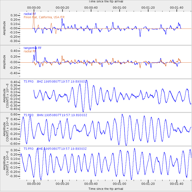
PFO Pinon Flat, California, USA - Earthquake Result Viewer
*The percent match for this event was below the threshold and hence no stack was calculated.
| Earthquake location: |
E. Caroline Islands, Micronesia |
| Earthquake latitude/longitude: |
4.1/143.7 |
| Earthquake time(UTC): |
1995/08/07 (219) 19:44:24 GMT |
| Earthquake Depth: |
10 km |
| Earthquake Magnitude: |
5.5 MB, 5.7 MS, 5.6 UNKNOWN, 6.4 MW |
| Earthquake Catalog/Contributor: |
WHDF/NEIC |
|
| Network: |
TS TERRAscope (Southern California Seismic Network) |
| Station: |
PFO Pinon Flat, California, USA |
| Lat/Lon: |
33.61 N/116.46 W |
| Elevation: |
1280 m |
|
| Distance: |
96.0 deg |
| Az: |
55.757 deg |
| Baz: |
278.858 deg |
| Ray Param: |
$rayparam |
*The percent match for this event was below the threshold and hence was not used in the summary stack. |
|
| Radial Match: |
57.514355 % |
| Radial Bump: |
400 |
| Transverse Match: |
70.412636 % |
| Transverse Bump: |
372 |
| SOD ConfigId: |
4480 |
| Insert Time: |
2010-02-26 14:43:57.896 +0000 |
| GWidth: |
2.5 |
| Max Bumps: |
400 |
| Tol: |
0.001 |
|
Signal To Noise
| Channel | StoN | STA | LTA |
| TS:PFO: :BHN:19950807T19:57:19.89303Z | 0.71581274 | 2.1970487E-7 | 3.0693064E-7 |
| TS:PFO: :BHE:19950807T19:57:19.89303Z | 1.6449577 | 2.5066524E-7 | 1.5238399E-7 |
| TS:PFO: :BHZ:19950807T19:57:19.89303Z | 3.3330064 | 2.8765706E-7 | 8.6305576E-8 |
| Arrivals |
| Ps | |
| PpPs | |
| PsPs/PpSs | |


