You are here: Home > Network List > UW - Pacific Northwest Regional Seismic Network Stations List
> Station UMAT Pilot Rock, OR, USA > Earthquake Result Viewer
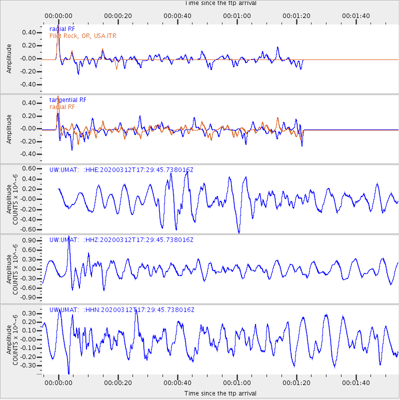
UMAT Pilot Rock, OR, USA - Earthquake Result Viewer
*The percent match for this event was below the threshold and hence no stack was calculated.
| Earthquake location: |
Near West Coast Of Honshu, Japan |
| Earthquake latitude/longitude: |
37.3/136.9 |
| Earthquake time(UTC): |
2020/03/12 (072) 17:18:46 GMT |
| Earthquake Depth: |
10 km |
| Earthquake Magnitude: |
5.3 Mww |
| Earthquake Catalog/Contributor: |
NEIC PDE/us |
|
| Network: |
UW Pacific Northwest Regional Seismic Network |
| Station: |
UMAT Pilot Rock, OR, USA |
| Lat/Lon: |
45.29 N/118.96 W |
| Elevation: |
1318 m |
|
| Distance: |
73.2 deg |
| Az: |
45.646 deg |
| Baz: |
306.097 deg |
| Ray Param: |
$rayparam |
*The percent match for this event was below the threshold and hence was not used in the summary stack. |
|
| Radial Match: |
61.573 % |
| Radial Bump: |
281 |
| Transverse Match: |
61.89737 % |
| Transverse Bump: |
400 |
| SOD ConfigId: |
20906531 |
| Insert Time: |
2020-04-08 09:54:31.994 +0000 |
| GWidth: |
2.5 |
| Max Bumps: |
400 |
| Tol: |
0.001 |
|
Signal To Noise
| Channel | StoN | STA | LTA |
| UW:UMAT: :HHZ:20200312T17:29:45.738016Z | 1.8013325 | 3.830437E-7 | 2.1264464E-7 |
| UW:UMAT: :HHN:20200312T17:29:45.738016Z | 1.8311874 | 2.2151133E-7 | 1.2096596E-7 |
| UW:UMAT: :HHE:20200312T17:29:45.738016Z | 1.4434818 | 2.2790113E-7 | 1.5788292E-7 |
| Arrivals |
| Ps | |
| PpPs | |
| PsPs/PpSs | |


