You are here: Home > Network List > TS - TERRAscope (Southern California Seismic Network) Stations List
> Station PFO Pinon Flat, California, USA > Earthquake Result Viewer
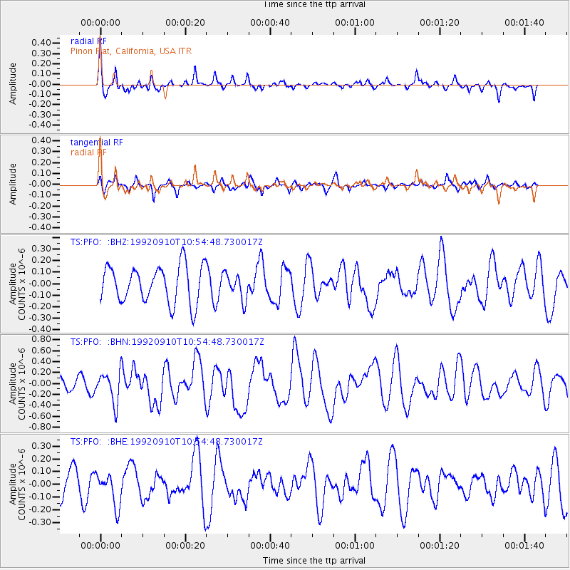
PFO Pinon Flat, California, USA - Earthquake Result Viewer
*The percent match for this event was below the threshold and hence no stack was calculated.
| Earthquake location: |
Tonga Islands Region |
| Earthquake latitude/longitude: |
-22.5/-175.1 |
| Earthquake time(UTC): |
1992/09/10 (254) 10:43:20 GMT |
| Earthquake Depth: |
39 km |
| Earthquake Magnitude: |
5.5 MB, 6.0 MS, 6.3 UNKNOWN |
| Earthquake Catalog/Contributor: |
WHDF/NEIC |
|
| Network: |
TS TERRAscope (Southern California Seismic Network) |
| Station: |
PFO Pinon Flat, California, USA |
| Lat/Lon: |
33.61 N/116.46 W |
| Elevation: |
1280 m |
|
| Distance: |
78.9 deg |
| Az: |
46.539 deg |
| Baz: |
233.536 deg |
| Ray Param: |
$rayparam |
*The percent match for this event was below the threshold and hence was not used in the summary stack. |
|
| Radial Match: |
67.87442 % |
| Radial Bump: |
340 |
| Transverse Match: |
53.427216 % |
| Transverse Bump: |
347 |
| SOD ConfigId: |
4480 |
| Insert Time: |
2010-02-26 14:43:58.396 +0000 |
| GWidth: |
2.5 |
| Max Bumps: |
400 |
| Tol: |
0.001 |
|
Signal To Noise
| Channel | StoN | STA | LTA |
| TS:PFO: :BHN:19920910T10:54:48.730017Z | 2.2666087 | 2.8668293E-7 | 1.26481E-7 |
| TS:PFO: :BHE:19920910T10:54:48.730017Z | 1.2539061 | 1.3284291E-7 | 1.0594327E-7 |
| TS:PFO: :BHZ:19920910T10:54:48.730017Z | 0.7005362 | 1.1218342E-7 | 1.6013936E-7 |
| Arrivals |
| Ps | |
| PpPs | |
| PsPs/PpSs | |


