S116 19 South Road - Earthquake Result Viewer
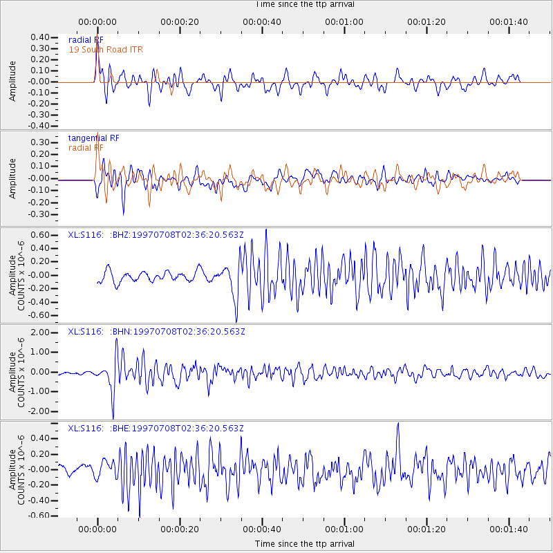
Earthquake location: Volcano Islands, Japan Region
Earthquake latitude/longitude: 23.8/142.7
Earthquake time(UTC): 1997/07/08 (189) 02:24:07 GMT
Earthquake Depth: 33 km
Earthquake Magnitude: 5.8 MB, 5.6 MS, 5.9 UNKNOWN, 5.8 MW
Earthquake Catalog/Contributor: WHDF/NEIC
Network: XL Deep Probe (Archean-Proterozoic)
Station: S116 19 South Road
Lat/Lon: 41.11 N/108.81 W
Elevation: 2230 m
Distance: 87.5 deg
Az: 45.83 deg
Baz: 299.603 deg
Ray Param: 0.04322528
Estimated Moho Depth: 22.75 km
Estimated Crust Vp/Vs: 1.77
Assumed Crust Vp: 6.207 km/s
Estimated Crust Vs: 3.512 km/s
Estimated Crust Poisson's Ratio: 0.26
Radial Match: 81.08551 %
Radial Bump: 400
Transverse Match: 69.31718 %
Transverse Bump: 400
SOD ConfigId: 4480
Insert Time: 2010-03-08 18:14:48.341 +0000
GWidth: 2.5
Max Bumps: 400
Tol: 0.001

Signal To Noise

ChannelStoNSTALTA
XL:S116: :BHN:19970708T02:36:20.563Z8.3802798.497006E-71.0139288E-7
XL:S116: :BHE:19970708T02:36:20.563Z1.77765671.10515366E-76.216913E-8
XL:S116: :BHZ:19970708T02:36:20.563Z3.5554442.642527E-77.43234E-8
Arrivals
Ps2.9 SECOND
PpPs9.9 SECOND
PsPs/PpSs13 SECOND