
S116 19 South Road - Earthquake Result Viewer
| ||||||||||||||||||
| ||||||||||||||||||
| ||||||||||||||||||
|
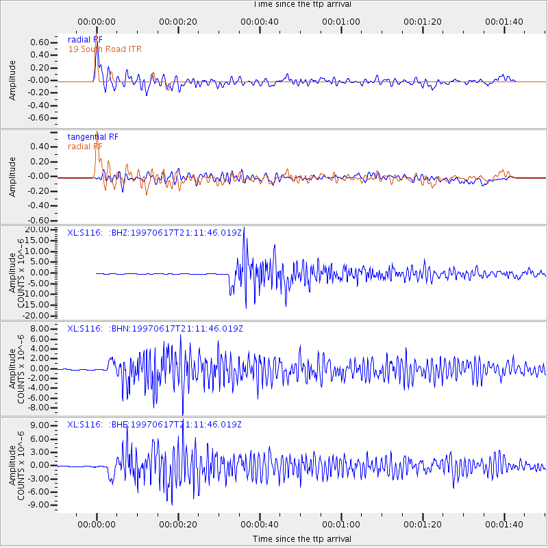
Signal To Noise
| Channel | StoN | STA | LTA |
| XL:S116: :BHN:19970617T21:11:46.019Z | 6.765427 | 1.1195268E-6 | 1.6547763E-7 |
| XL:S116: :BHE:19970617T21:11:46.019Z | 17.565392 | 1.5667625E-6 | 8.919599E-8 |
| XL:S116: :BHZ:19970617T21:11:46.019Z | 76.22391 | 3.89628E-6 | 5.1116242E-8 |
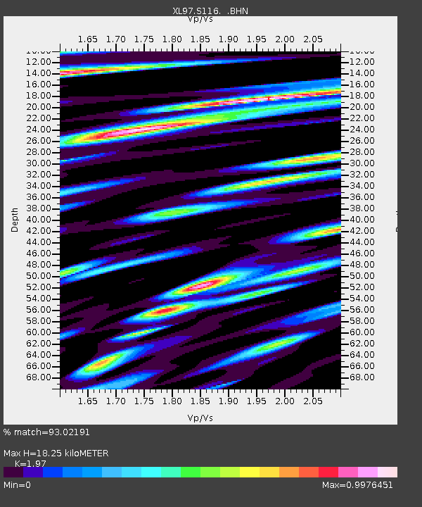
| Arrivals | |
| Ps | 3.0 SECOND |
| PpPs | 8.3 SECOND |
| PsPs/PpSs | 11 SECOND |

