
S116 19 South Road - Earthquake Result Viewer
| ||||||||||||||||||
| ||||||||||||||||||
| ||||||||||||||||||
|
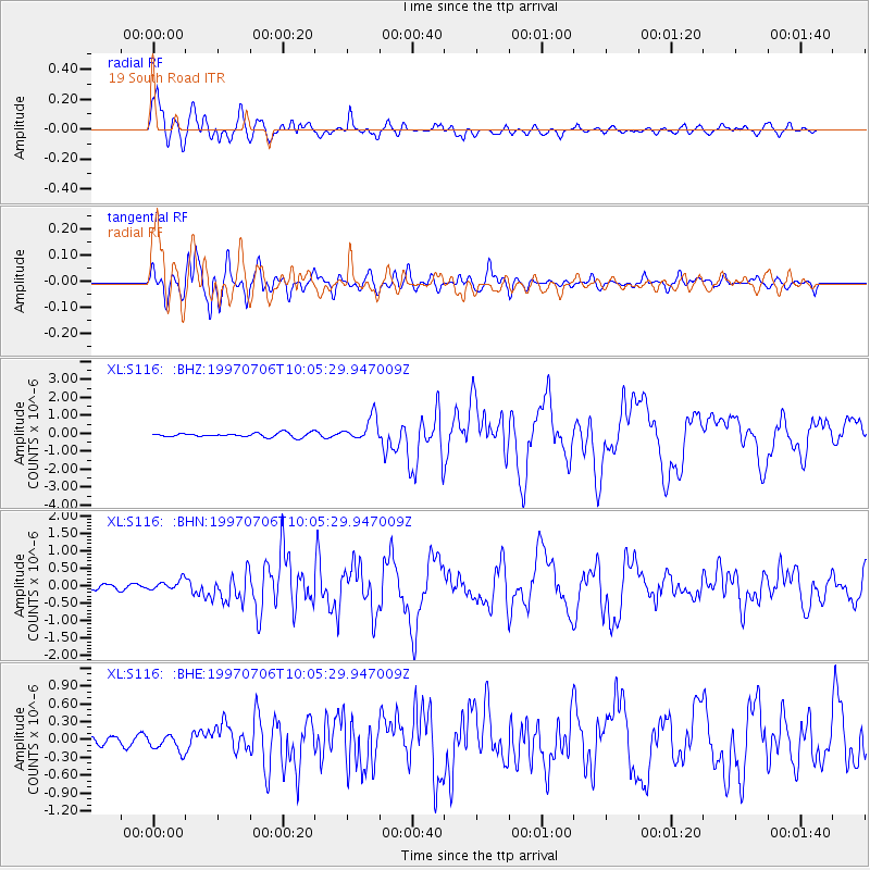
Signal To Noise
| Channel | StoN | STA | LTA |
| XL:S116: :BHN:19970706T10:05:29.947009Z | 1.8132545 | 1.4484098E-7 | 7.9879015E-8 |
| XL:S116: :BHE:19970706T10:05:29.947009Z | 1.346292 | 1.3855058E-7 | 1.0291272E-7 |
| XL:S116: :BHZ:19970706T10:05:29.947009Z | 5.9723754 | 6.6179825E-7 | 1.10809886E-7 |
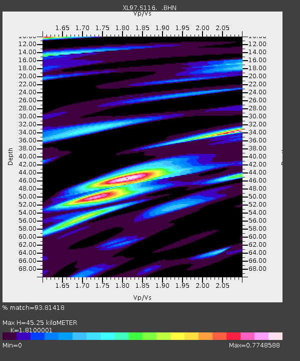
| Arrivals | |
| Ps | 6.1 SECOND |
| PpPs | 20 SECOND |
| PsPs/PpSs | 26 SECOND |

