
S116 19 South Road - Earthquake Result Viewer
| ||||||||||||||||||
| ||||||||||||||||||
| ||||||||||||||||||
|
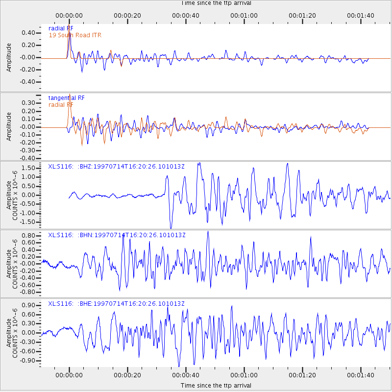
Signal To Noise
| Channel | StoN | STA | LTA |
| XL:S116: :BHN:19970714T16:20:26.101013Z | 2.2583618 | 1.6789993E-7 | 7.434589E-8 |
| XL:S116: :BHE:19970714T16:20:26.101013Z | 2.1176476 | 1.5396697E-7 | 7.2706605E-8 |
| XL:S116: :BHZ:19970714T16:20:26.101013Z | 7.0018473 | 5.609941E-7 | 8.012088E-8 |
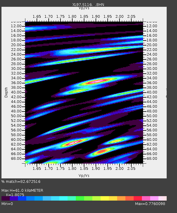
| Arrivals | |
| Ps | 8.2 SECOND |
| PpPs | 27 SECOND |
| PsPs/PpSs | 35 SECOND |

