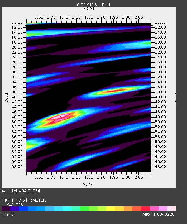
S116 19 South Road - Earthquake Result Viewer
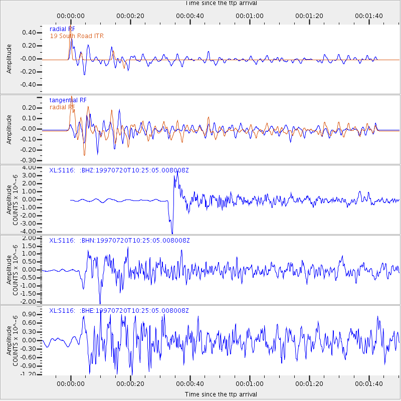
Earthquake location: Jujuy Province, Argentina
Earthquake latitude/longitude: -23.0/-66.3
Earthquake time(UTC): 1997/07/20 (201) 10:14:22 GMT
Earthquake Depth: 256 km
Earthquake Magnitude: 5.7 MB, 6.1 UNKNOWN, 5.7 ME
Earthquake Catalog/Contributor: WHDF/NEIC
Network: XL Deep Probe (Archean-Proterozoic)
Station: S116 19 South Road
Lat/Lon: 41.11 N/108.81 W
Elevation: 2230 m
Distance: 75.0 deg
Az: 328.088 deg
Baz: 139.857 deg
Ray Param: 0.05127111
Estimated Moho Depth: 47.5 km
Estimated Crust Vp/Vs: 1.74
Assumed Crust Vp: 6.207 km/s
Estimated Crust Vs: 3.578 km/s
Estimated Crust Poisson's Ratio: 0.25
Radial Match: 84.91954 %
Radial Bump: 400
Transverse Match: 84.64345 %
Transverse Bump: 400
SOD ConfigId: 6273
Insert Time: 2010-03-08 18:14:55.940 +0000
GWidth: 2.5
Max Bumps: 400
Tol: 0.001

Signal To Noise

ChannelStoNSTALTA
XL:S116: :BHN:19970720T10:25:05.008008Z3.68509444.129837E-71.120687E-7
XL:S116: :BHE:19970720T10:25:05.008008Z3.11763953.2710707E-71.0492139E-7
XL:S116: :BHZ:19970720T10:25:05.008008Z14.6507291.6838827E-61.1493508E-7
Arrivals
Ps5.8 SECOND
PpPs20 SECOND
PsPs/PpSs26 SECOND