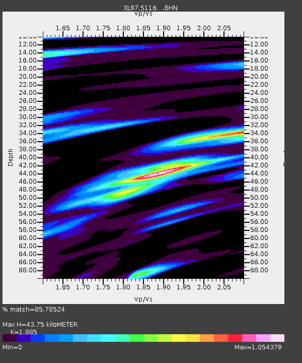
S116 19 South Road - Earthquake Result Viewer
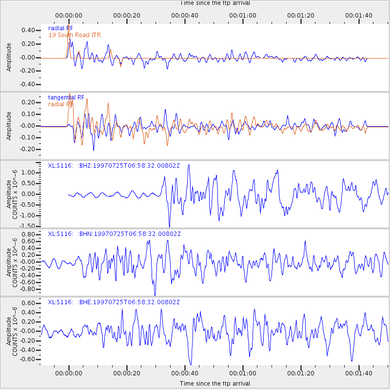
Earthquake location: Near Coast Of Central Chile
Earthquake latitude/longitude: -30.5/-71.9
Earthquake time(UTC): 1997/07/25 (206) 06:47:02 GMT
Earthquake Depth: 33 km
Earthquake Magnitude: 5.6 MB, 5.5 MS, 6.3 UNKNOWN
Earthquake Catalog/Contributor: WHDF/NEIC
Network: XL Deep Probe (Archean-Proterozoic)
Station: S116 19 South Road
Lat/Lon: 41.11 N/108.81 W
Elevation: 2230 m
Distance: 79.0 deg
Az: 332.466 deg
Baz: 148.115 deg
Ray Param: 0.049236562
Estimated Moho Depth: 43.75 km
Estimated Crust Vp/Vs: 1.88
Assumed Crust Vp: 6.207 km/s
Estimated Crust Vs: 3.293 km/s
Estimated Crust Poisson's Ratio: 0.30
Radial Match: 85.78524 %
Radial Bump: 400
Transverse Match: 77.549965 %
Transverse Bump: 400
SOD ConfigId: 6273
Insert Time: 2010-03-08 18:14:56.725 +0000
GWidth: 2.5
Max Bumps: 400
Tol: 0.001

Signal To Noise

ChannelStoNSTALTA
XL:S116: :BHN:19970725T06:58:32.00802Z1.03474779.3303214E-89.017001E-8
XL:S116: :BHE:19970725T06:58:32.00802Z0.85822797.3302004E-88.541088E-8
XL:S116: :BHZ:19970725T06:58:32.00802Z5.62257864.843943E-78.615163E-8
Arrivals
Ps6.4 SECOND
PpPs20 SECOND
PsPs/PpSs26 SECOND