S116 19 South Road - Earthquake Result Viewer
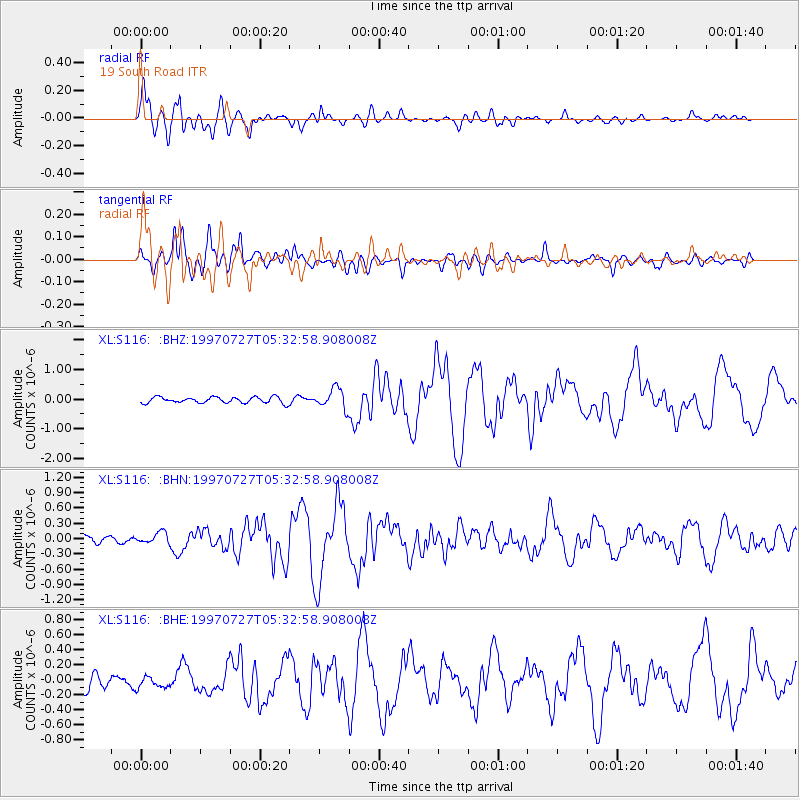
Earthquake location: Near Coast Of Central Chile
Earthquake latitude/longitude: -30.5/-71.9
Earthquake time(UTC): 1997/07/27 (208) 05:21:29 GMT
Earthquake Depth: 33 km
Earthquake Magnitude: 5.6 MB, 5.8 MS, 6.3 UNKNOWN, 6.2 MW
Earthquake Catalog/Contributor: WHDF/NEIC
Network: XL Deep Probe (Archean-Proterozoic)
Station: S116 19 South Road
Lat/Lon: 41.11 N/108.81 W
Elevation: 2230 m
Distance: 79.0 deg
Az: 332.443 deg
Baz: 148.106 deg
Ray Param: 0.049191248
Estimated Moho Depth: 14.5 km
Estimated Crust Vp/Vs: 1.60
Assumed Crust Vp: 6.207 km/s
Estimated Crust Vs: 3.879 km/s
Estimated Crust Poisson's Ratio: 0.18
Radial Match: 94.708916 %
Radial Bump: 400
Transverse Match: 84.95731 %
Transverse Bump: 400
SOD ConfigId: 6273
Insert Time: 2010-03-08 18:14:57.462 +0000
GWidth: 2.5
Max Bumps: 400
Tol: 0.001

Signal To Noise

ChannelStoNSTALTA
XL:S116: :BHN:19970727T05:32:58.908008Z1.7668251.1070002E-76.265478E-8
XL:S116: :BHE:19970727T05:32:58.908008Z0.81504377.847277E-89.628045E-8
XL:S116: :BHZ:19970727T05:32:58.908008Z3.35021233.3015692E-79.8548064E-8
Arrivals
Ps1.4 SECOND
PpPs5.9 SECOND
PsPs/PpSs7.3 SECOND