You are here: Home > Network List > AZ - ANZA Regional Network Stations List
> Station SMER AZ.SMER > Earthquake Result Viewer
SMER AZ.SMER - Earthquake Result Viewer
*The percent match for this event was below the threshold and hence no stack was calculated.
| Earthquake location: |
Kermadec Islands Region |
| Earthquake latitude/longitude: |
-27.4/-175.7 |
| Earthquake time(UTC): |
2020/03/14 (074) 10:01:17 GMT |
| Earthquake Depth: |
10 km |
| Earthquake Magnitude: |
6.3 Mww |
| Earthquake Catalog/Contributor: |
NEIC PDE/us |
|
| Network: |
AZ ANZA Regional Network |
| Station: |
SMER AZ.SMER |
| Lat/Lon: |
33.46 N/117.17 W |
| Elevation: |
355 m |
|
| Distance: |
82.1 deg |
| Az: |
46.027 deg |
| Baz: |
229.927 deg |
| Ray Param: |
$rayparam |
*The percent match for this event was below the threshold and hence was not used in the summary stack. |
|
| Radial Match: |
51.365143 % |
| Radial Bump: |
400 |
| Transverse Match: |
66.10483 % |
| Transverse Bump: |
400 |
| SOD ConfigId: |
20906531 |
| Insert Time: |
2020-04-08 10:18:13.370 +0000 |
| GWidth: |
2.5 |
| Max Bumps: |
400 |
| Tol: |
0.001 |
|
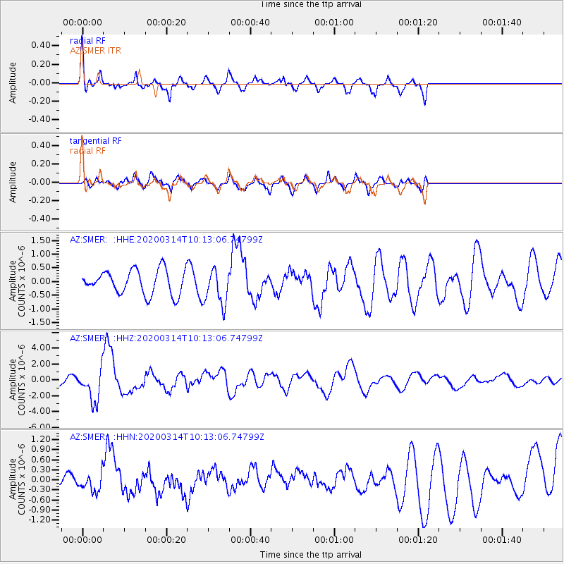
Signal To Noise
| Channel | StoN | STA | LTA |
| AZ:SMER: :HHZ:20200314T10:13:06.74799Z | 4.3802614 | 2.044212E-6 | 4.6668723E-7 |
| AZ:SMER: :HHN:20200314T10:13:06.74799Z | 0.64543176 | 2.6073147E-7 | 4.039644E-7 |
| AZ:SMER: :HHE:20200314T10:13:06.74799Z | 1.4757447 | 6.491848E-7 | 4.399032E-7 |
| Arrivals |
| Ps | |
| PpPs | |
| PsPs/PpSs | |


