
S118 Raftopoulos Place - Earthquake Result Viewer
| ||||||||||||||||||
| ||||||||||||||||||
| ||||||||||||||||||
|
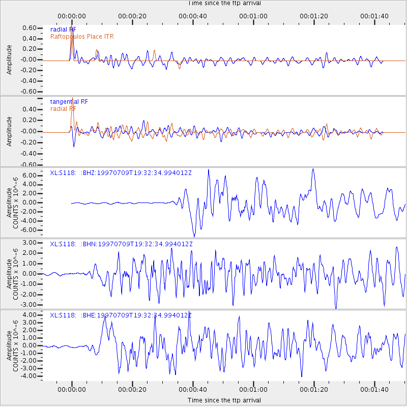
Signal To Noise
| Channel | StoN | STA | LTA |
| XL:S118: :BHN:19970709T19:32:34.994012Z | 0.3579769 | 4.192367E-8 | 1.17112776E-7 |
| XL:S118: :BHE:19970709T19:32:34.994012Z | 0.91633725 | 1.0274102E-7 | 1.121214E-7 |
| XL:S118: :BHZ:19970709T19:32:34.994012Z | 1.917966 | 1.977193E-7 | 1.0308801E-7 |
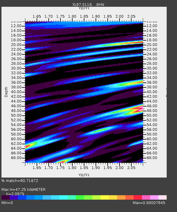
| Arrivals | |
| Ps | 8.7 SECOND |
| PpPs | 23 SECOND |
| PsPs/PpSs | 31 SECOND |

