You are here: Home > Network List > CI - Caltech Regional Seismic Network Stations List
> Station SMM Simmler, CA, USA > Earthquake Result Viewer
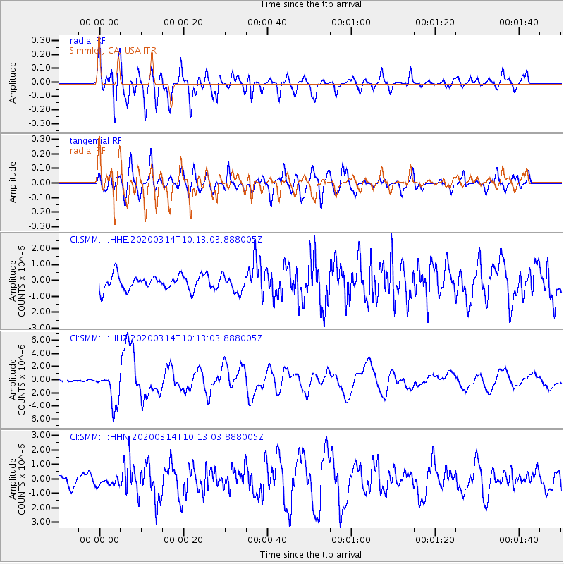
SMM Simmler, CA, USA - Earthquake Result Viewer
*The percent match for this event was below the threshold and hence no stack was calculated.
| Earthquake location: |
Kermadec Islands Region |
| Earthquake latitude/longitude: |
-27.4/-175.7 |
| Earthquake time(UTC): |
2020/03/14 (074) 10:01:17 GMT |
| Earthquake Depth: |
10 km |
| Earthquake Magnitude: |
6.3 Mww |
| Earthquake Catalog/Contributor: |
NEIC PDE/us |
|
| Network: |
CI Caltech Regional Seismic Network |
| Station: |
SMM Simmler, CA, USA |
| Lat/Lon: |
35.31 N/120.00 W |
| Elevation: |
599 m |
|
| Distance: |
81.6 deg |
| Az: |
43.066 deg |
| Baz: |
227.92 deg |
| Ray Param: |
$rayparam |
*The percent match for this event was below the threshold and hence was not used in the summary stack. |
|
| Radial Match: |
75.44717 % |
| Radial Bump: |
400 |
| Transverse Match: |
63.88939 % |
| Transverse Bump: |
400 |
| SOD ConfigId: |
20906531 |
| Insert Time: |
2020-04-08 10:22:59.414 +0000 |
| GWidth: |
2.5 |
| Max Bumps: |
400 |
| Tol: |
0.001 |
|
Signal To Noise
| Channel | StoN | STA | LTA |
| CI:SMM: :HHZ:20200314T10:13:03.888005Z | 7.2038417 | 2.6151315E-6 | 3.63019E-7 |
| CI:SMM: :HHN:20200314T10:13:03.888005Z | 0.55891854 | 3.0336724E-7 | 5.427754E-7 |
| CI:SMM: :HHE:20200314T10:13:03.888005Z | 1.1749626 | 5.291267E-7 | 4.5033488E-7 |
| Arrivals |
| Ps | |
| PpPs | |
| PsPs/PpSs | |


