You are here: Home > Network List > US - United States National Seismic Network Stations List
> Station LAO LASA Array, Montana, USA > Earthquake Result Viewer
LAO LASA Array, Montana, USA - Earthquake Result Viewer
*The percent match for this event was below the threshold and hence no stack was calculated.
| Earthquake location: |
Andreanof Islands, Aleutian Is. |
| Earthquake latitude/longitude: |
51.1/-177.0 |
| Earthquake time(UTC): |
2017/05/08 (128) 15:31:28 GMT |
| Earthquake Depth: |
41 km |
| Earthquake Magnitude: |
5.5 Ml |
| Earthquake Catalog/Contributor: |
NEIC PDE/ak |
|
| Network: |
US United States National Seismic Network |
| Station: |
LAO LASA Array, Montana, USA |
| Lat/Lon: |
46.69 N/106.22 W |
| Elevation: |
902 m |
|
| Distance: |
45.1 deg |
| Az: |
66.552 deg |
| Baz: |
302.769 deg |
| Ray Param: |
$rayparam |
*The percent match for this event was below the threshold and hence was not used in the summary stack. |
|
| Radial Match: |
70.2222 % |
| Radial Bump: |
400 |
| Transverse Match: |
57.978962 % |
| Transverse Bump: |
400 |
| SOD ConfigId: |
2028011 |
| Insert Time: |
2017-05-22 15:37:18.989 +0000 |
| GWidth: |
2.5 |
| Max Bumps: |
400 |
| Tol: |
0.001 |
|
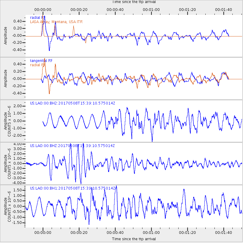
Signal To Noise
| Channel | StoN | STA | LTA |
| US:LAO:00:BHZ:20170508T15:39:10.575014Z | 8.866188 | 1.3950853E-6 | 1.5734895E-7 |
| US:LAO:00:BH1:20170508T15:39:10.575014Z | 1.1745863 | 4.6699714E-7 | 3.9758436E-7 |
| US:LAO:00:BH2:20170508T15:39:10.575014Z | 1.3036108 | 7.737951E-7 | 5.935783E-7 |
| Arrivals |
| Ps | |
| PpPs | |
| PsPs/PpSs | |


