You are here: Home > Network List > TS - TERRAscope (Southern California Seismic Network) Stations List
> Station PFO Pinon Flat, California, USA > Earthquake Result Viewer
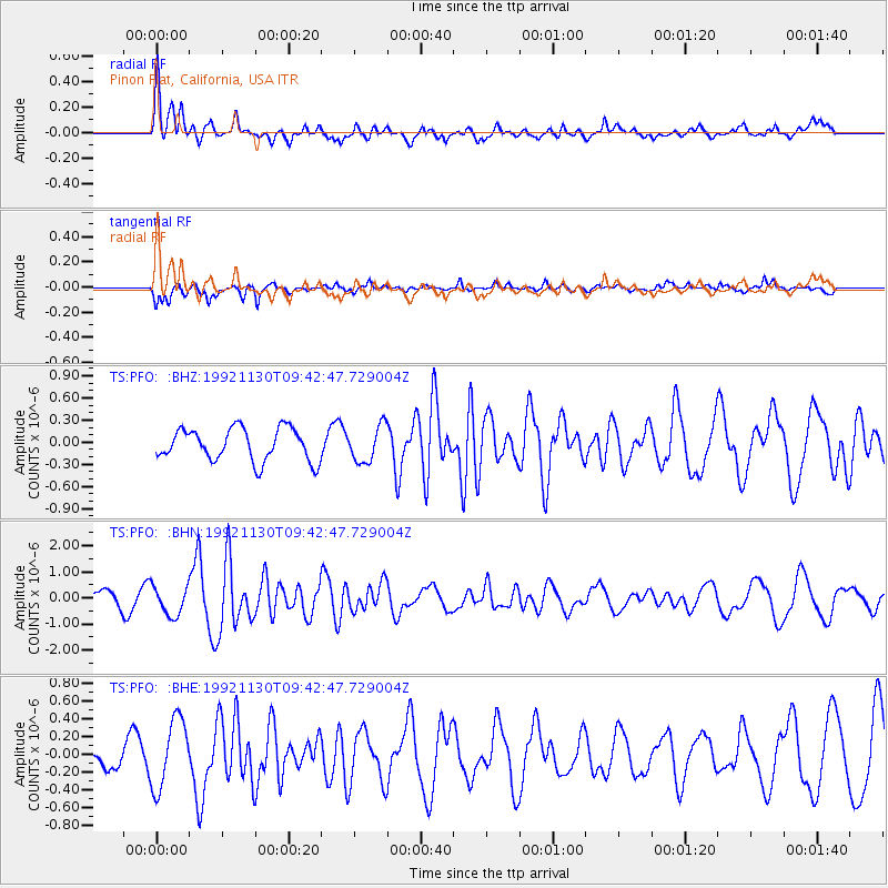
PFO Pinon Flat, California, USA - Earthquake Result Viewer
*The percent match for this event was below the threshold and hence no stack was calculated.
| Earthquake location: |
Azores Islands Region |
| Earthquake latitude/longitude: |
35.6/-34.6 |
| Earthquake time(UTC): |
1992/11/30 (335) 09:32:36 GMT |
| Earthquake Depth: |
10 km |
| Earthquake Magnitude: |
6.0 MB, 5.7 MS |
| Earthquake Catalog/Contributor: |
WHDF/NEIC |
|
| Network: |
TS TERRAscope (Southern California Seismic Network) |
| Station: |
PFO Pinon Flat, California, USA |
| Lat/Lon: |
33.61 N/116.46 W |
| Elevation: |
1280 m |
|
| Distance: |
65.4 deg |
| Az: |
294.72 deg |
| Baz: |
62.443 deg |
| Ray Param: |
$rayparam |
*The percent match for this event was below the threshold and hence was not used in the summary stack. |
|
| Radial Match: |
72.52368 % |
| Radial Bump: |
400 |
| Transverse Match: |
69.24024 % |
| Transverse Bump: |
363 |
| SOD ConfigId: |
4480 |
| Insert Time: |
2010-02-26 14:44:03.181 +0000 |
| GWidth: |
2.5 |
| Max Bumps: |
400 |
| Tol: |
0.001 |
|
Signal To Noise
| Channel | StoN | STA | LTA |
| TS:PFO: :BHN:19921130T09:42:47.729004Z | 2.4238594 | 5.563552E-7 | 2.2953279E-7 |
| TS:PFO: :BHE:19921130T09:42:47.729004Z | 2.06966 | 3.876167E-7 | 1.8728521E-7 |
| TS:PFO: :BHZ:19921130T09:42:47.729004Z | 1.1084394 | 2.4301883E-7 | 2.1924411E-7 |
| Arrivals |
| Ps | |
| PpPs | |
| PsPs/PpSs | |


