You are here: Home > Network List > TS - TERRAscope (Southern California Seismic Network) Stations List
> Station PFO Pinon Flat, California, USA > Earthquake Result Viewer
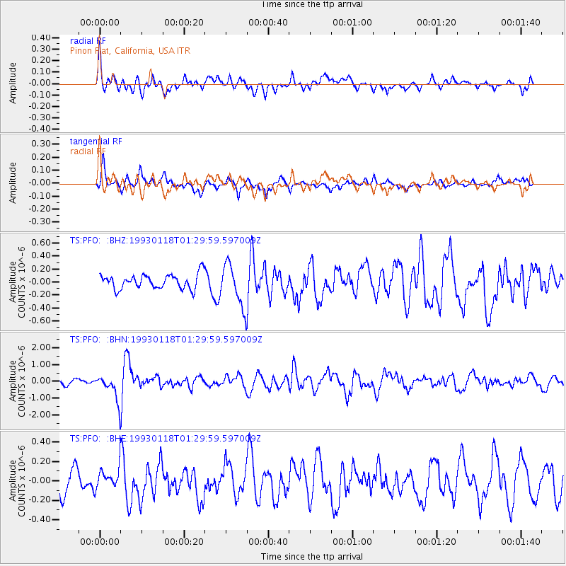
PFO Pinon Flat, California, USA - Earthquake Result Viewer
*The percent match for this event was below the threshold and hence no stack was calculated.
| Earthquake location: |
Mariana Islands |
| Earthquake latitude/longitude: |
18.4/145.7 |
| Earthquake time(UTC): |
1993/01/18 (018) 01:18:08 GMT |
| Earthquake Depth: |
169 km |
| Earthquake Magnitude: |
5.7 MB |
| Earthquake Catalog/Contributor: |
WHDF/NEIC |
|
| Network: |
TS TERRAscope (Southern California Seismic Network) |
| Station: |
PFO Pinon Flat, California, USA |
| Lat/Lon: |
33.61 N/116.46 W |
| Elevation: |
1280 m |
|
| Distance: |
86.3 deg |
| Az: |
55.944 deg |
| Baz: |
289.483 deg |
| Ray Param: |
$rayparam |
*The percent match for this event was below the threshold and hence was not used in the summary stack. |
|
| Radial Match: |
58.36172 % |
| Radial Bump: |
400 |
| Transverse Match: |
58.009842 % |
| Transverse Bump: |
362 |
| SOD ConfigId: |
4480 |
| Insert Time: |
2010-02-26 14:44:03.685 +0000 |
| GWidth: |
2.5 |
| Max Bumps: |
400 |
| Tol: |
0.001 |
|
Signal To Noise
| Channel | StoN | STA | LTA |
| TS:PFO: :BHN:19930118T01:29:59.597009Z | 5.140052 | 7.8372864E-7 | 1.5247484E-7 |
| TS:PFO: :BHE:19930118T01:29:59.597009Z | 0.65875435 | 1.04013274E-7 | 1.5789387E-7 |
| TS:PFO: :BHZ:19930118T01:29:59.597009Z | 3.00931 | 3.33245E-7 | 1.10738014E-7 |
| Arrivals |
| Ps | |
| PpPs | |
| PsPs/PpSs | |


