You are here: Home > Network List > TS - TERRAscope (Southern California Seismic Network) Stations List
> Station PFO Pinon Flat, California, USA > Earthquake Result Viewer
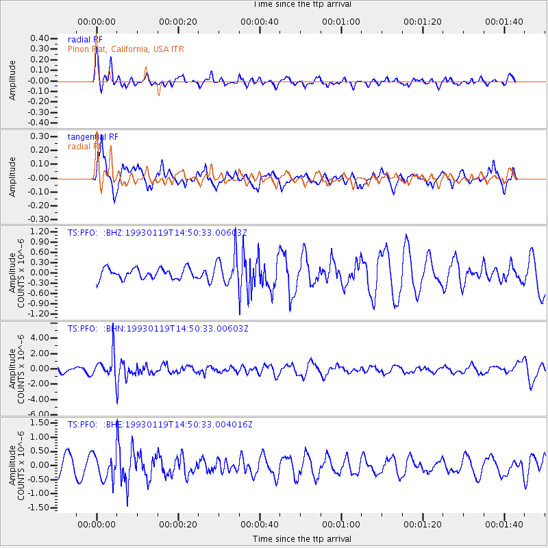
PFO Pinon Flat, California, USA - Earthquake Result Viewer
*The percent match for this event was below the threshold and hence no stack was calculated.
| Earthquake location: |
Sea Of Japan |
| Earthquake latitude/longitude: |
38.6/133.5 |
| Earthquake time(UTC): |
1993/01/19 (019) 14:39:26 GMT |
| Earthquake Depth: |
455 km |
| Earthquake Magnitude: |
6.0 MB |
| Earthquake Catalog/Contributor: |
WHDF/NEIC |
|
| Network: |
TS TERRAscope (Southern California Seismic Network) |
| Station: |
PFO Pinon Flat, California, USA |
| Lat/Lon: |
33.61 N/116.46 W |
| Elevation: |
1280 m |
|
| Distance: |
83.2 deg |
| Az: |
52.121 deg |
| Baz: |
312.2 deg |
| Ray Param: |
$rayparam |
*The percent match for this event was below the threshold and hence was not used in the summary stack. |
|
| Radial Match: |
56.236244 % |
| Radial Bump: |
352 |
| Transverse Match: |
60.327347 % |
| Transverse Bump: |
400 |
| SOD ConfigId: |
4480 |
| Insert Time: |
2010-02-26 14:44:04.493 +0000 |
| GWidth: |
2.5 |
| Max Bumps: |
400 |
| Tol: |
0.001 |
|
Signal To Noise
| Channel | StoN | STA | LTA |
| TS:PFO: :BHN:19930119T14:50:33.00603Z | 4.828435 | 1.6547525E-6 | 3.427099E-7 |
| TS:PFO: :BHE:19930119T14:50:33.004016Z | 1.235846 | 4.4387153E-7 | 3.591641E-7 |
| TS:PFO: :BHZ:19930119T14:50:33.00603Z | 2.8906496 | 4.4143766E-7 | 1.5271227E-7 |
| Arrivals |
| Ps | |
| PpPs | |
| PsPs/PpSs | |


