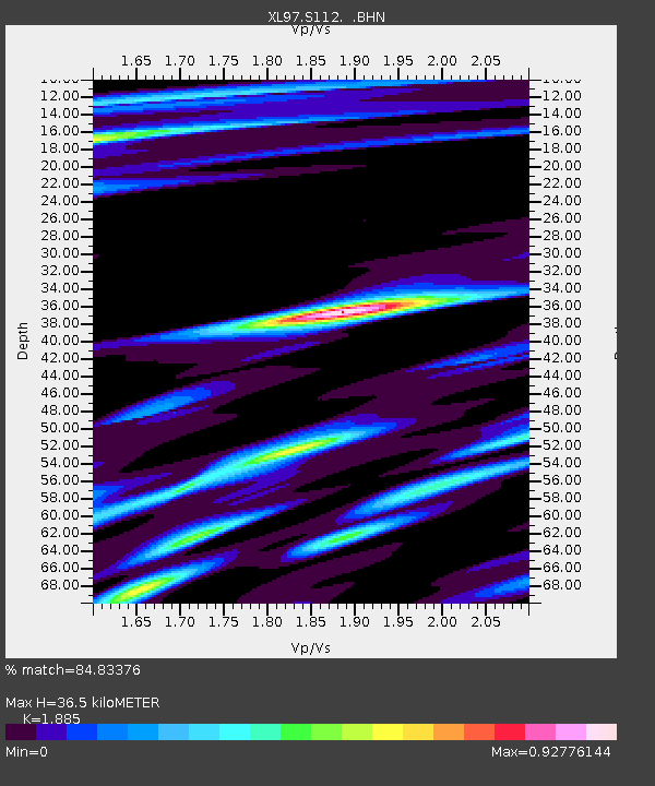
S112 Sandy Bluffs - Earthquake Result Viewer
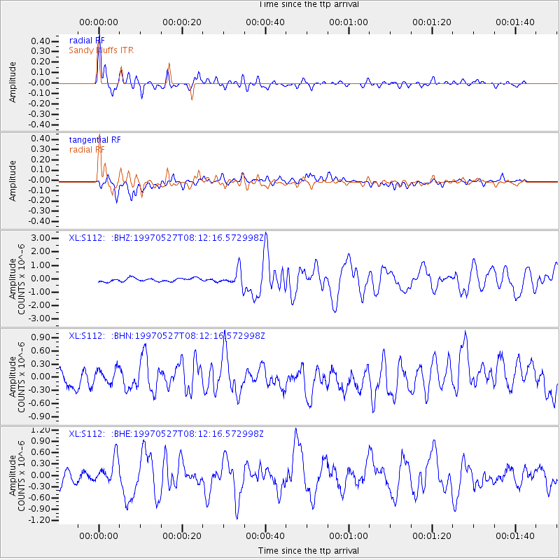
Earthquake location: Tonga Islands
Earthquake latitude/longitude: -15.2/-173.3
Earthquake time(UTC): 1997/05/27 (147) 08:00:29 GMT
Earthquake Depth: 14 km
Earthquake Magnitude: 5.6 MB, 6.3 MS, 6.4 UNKNOWN, 5.7 ME
Earthquake Catalog/Contributor: WHDF/NEIC
Network: XL Deep Probe (Archean-Proterozoic)
Station: S112 Sandy Bluffs
Lat/Lon: 41.46 N/108.85 W
Elevation: 2138 m
Distance: 81.9 deg
Az: 43.245 deg
Baz: 241.637 deg
Ray Param: 0.04724447
Estimated Moho Depth: 36.5 km
Estimated Crust Vp/Vs: 1.88
Assumed Crust Vp: 6.207 km/s
Estimated Crust Vs: 3.293 km/s
Estimated Crust Poisson's Ratio: 0.30
Radial Match: 84.83376 %
Radial Bump: 385
Transverse Match: 60.6251 %
Transverse Bump: 400
SOD ConfigId: 6273
Insert Time: 2010-03-08 18:15:57.557 +0000
GWidth: 2.5
Max Bumps: 400
Tol: 0.001

Signal To Noise

ChannelStoNSTALTA
XL:S112: :BHN:19970527T08:12:16.572998Z1.39870871.9861103E-71.41996E-7
XL:S112: :BHE:19970527T08:12:16.572998Z1.70978713.3718933E-71.972113E-7
XL:S112: :BHZ:19970527T08:12:16.572998Z4.74883846.096403E-71.2837671E-7
Arrivals
Ps5.3 SECOND
PpPs17 SECOND
PsPs/PpSs22 SECOND