You are here: Home > Network List > TA - USArray Transportable Network (new EarthScope stations) Stations List
> Station F20K Avaraart Lake, AK, USA > Earthquake Result Viewer
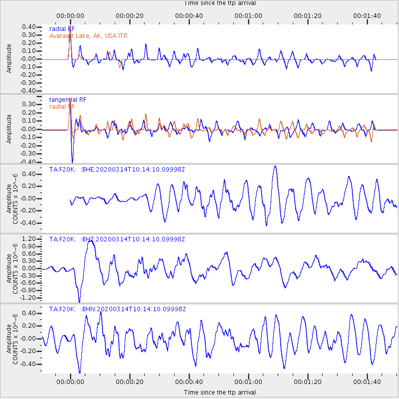
F20K Avaraart Lake, AK, USA - Earthquake Result Viewer
*The percent match for this event was below the threshold and hence no stack was calculated.
| Earthquake location: |
Kermadec Islands Region |
| Earthquake latitude/longitude: |
-27.4/-175.7 |
| Earthquake time(UTC): |
2020/03/14 (074) 10:01:17 GMT |
| Earthquake Depth: |
10 km |
| Earthquake Magnitude: |
6.3 Mww |
| Earthquake Catalog/Contributor: |
NEIC PDE/us |
|
| Network: |
TA USArray Transportable Network (new EarthScope stations) |
| Station: |
F20K Avaraart Lake, AK, USA |
| Lat/Lon: |
67.05 N/155.73 W |
| Elevation: |
136 m |
|
| Distance: |
95.4 deg |
| Az: |
7.728 deg |
| Baz: |
197.745 deg |
| Ray Param: |
$rayparam |
*The percent match for this event was below the threshold and hence was not used in the summary stack. |
|
| Radial Match: |
60.811832 % |
| Radial Bump: |
400 |
| Transverse Match: |
59.58036 % |
| Transverse Bump: |
400 |
| SOD ConfigId: |
20906531 |
| Insert Time: |
2020-04-08 10:33:53.233 +0000 |
| GWidth: |
2.5 |
| Max Bumps: |
400 |
| Tol: |
0.001 |
|
Signal To Noise
| Channel | StoN | STA | LTA |
| TA:F20K: :BHZ:20200314T10:14:10.09998Z | 6.723138 | 5.984775E-7 | 8.901759E-8 |
| TA:F20K: :BHN:20200314T10:14:10.09998Z | 2.2276976 | 2.3713281E-7 | 1.0644749E-7 |
| TA:F20K: :BHE:20200314T10:14:10.09998Z | 5.698812 | 2.1896204E-7 | 3.8422403E-8 |
| Arrivals |
| Ps | |
| PpPs | |
| PsPs/PpSs | |


