You are here: Home > Network List > UW - Pacific Northwest Regional Seismic Network Stations List
> Station IRON Crane, OR, USA > Earthquake Result Viewer
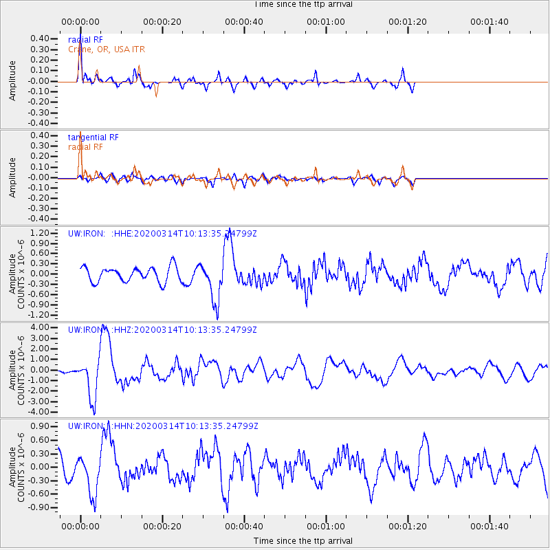
IRON Crane, OR, USA - Earthquake Result Viewer
*The percent match for this event was below the threshold and hence no stack was calculated.
| Earthquake location: |
Kermadec Islands Region |
| Earthquake latitude/longitude: |
-27.4/-175.7 |
| Earthquake time(UTC): |
2020/03/14 (074) 10:01:17 GMT |
| Earthquake Depth: |
10 km |
| Earthquake Magnitude: |
6.3 Mww |
| Earthquake Catalog/Contributor: |
NEIC PDE/us |
|
| Network: |
UW Pacific Northwest Regional Seismic Network |
| Station: |
IRON Crane, OR, USA |
| Lat/Lon: |
43.36 N/118.47 W |
| Elevation: |
1226 m |
|
| Distance: |
87.8 deg |
| Az: |
37.85 deg |
| Baz: |
228.401 deg |
| Ray Param: |
$rayparam |
*The percent match for this event was below the threshold and hence was not used in the summary stack. |
|
| Radial Match: |
74.70818 % |
| Radial Bump: |
342 |
| Transverse Match: |
47.452538 % |
| Transverse Bump: |
400 |
| SOD ConfigId: |
20906531 |
| Insert Time: |
2020-04-08 10:41:06.497 +0000 |
| GWidth: |
2.5 |
| Max Bumps: |
400 |
| Tol: |
0.001 |
|
Signal To Noise
| Channel | StoN | STA | LTA |
| UW:IRON: :HHZ:20200314T10:13:35.24799Z | 10.823691 | 1.913905E-6 | 1.7682552E-7 |
| UW:IRON: :HHN:20200314T10:13:35.24799Z | 2.7580569 | 4.5330262E-7 | 1.6435578E-7 |
| UW:IRON: :HHE:20200314T10:13:35.24799Z | 2.727221 | 5.840167E-7 | 2.1414351E-7 |
| Arrivals |
| Ps | |
| PpPs | |
| PsPs/PpSs | |


