You are here: Home > Network List > TS - TERRAscope (Southern California Seismic Network) Stations List
> Station PFO Pinon Flat, California, USA > Earthquake Result Viewer
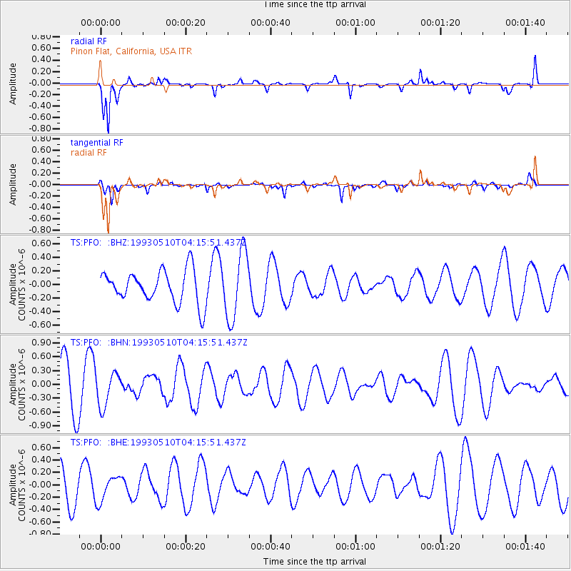
PFO Pinon Flat, California, USA - Earthquake Result Viewer
*The percent match for this event was below the threshold and hence no stack was calculated.
| Earthquake location: |
Southern East Pacific Rise |
| Earthquake latitude/longitude: |
-53.0/-118.0 |
| Earthquake time(UTC): |
1993/05/10 (130) 04:03:41 GMT |
| Earthquake Depth: |
10 km |
| Earthquake Magnitude: |
5.6 MS, 5.1 MB |
| Earthquake Catalog/Contributor: |
WHDF/NEIC |
|
| Network: |
TS TERRAscope (Southern California Seismic Network) |
| Station: |
PFO Pinon Flat, California, USA |
| Lat/Lon: |
33.61 N/116.46 W |
| Elevation: |
1280 m |
|
| Distance: |
86.3 deg |
| Az: |
1.313 deg |
| Baz: |
180.951 deg |
| Ray Param: |
$rayparam |
*The percent match for this event was below the threshold and hence was not used in the summary stack. |
|
| Radial Match: |
85.50585 % |
| Radial Bump: |
400 |
| Transverse Match: |
58.45652 % |
| Transverse Bump: |
345 |
| SOD ConfigId: |
4480 |
| Insert Time: |
2010-02-26 14:44:08.578 +0000 |
| GWidth: |
2.5 |
| Max Bumps: |
400 |
| Tol: |
0.001 |
|
Signal To Noise
| Channel | StoN | STA | LTA |
| TS:PFO: :BHN:19930510T04:15:51.437Z | 0.9702973 | 3.6915898E-7 | 3.8045968E-7 |
| TS:PFO: :BHE:19930510T04:15:51.437Z | 0.8576682 | 2.0319085E-7 | 2.3691078E-7 |
| TS:PFO: :BHZ:19930510T04:15:51.437Z | 2.108095 | 5.042188E-7 | 2.391822E-7 |
| Arrivals |
| Ps | |
| PpPs | |
| PsPs/PpSs | |


