You are here: Home > Network List > TS - TERRAscope (Southern California Seismic Network) Stations List
> Station PFO Pinon Flat, California, USA > Earthquake Result Viewer
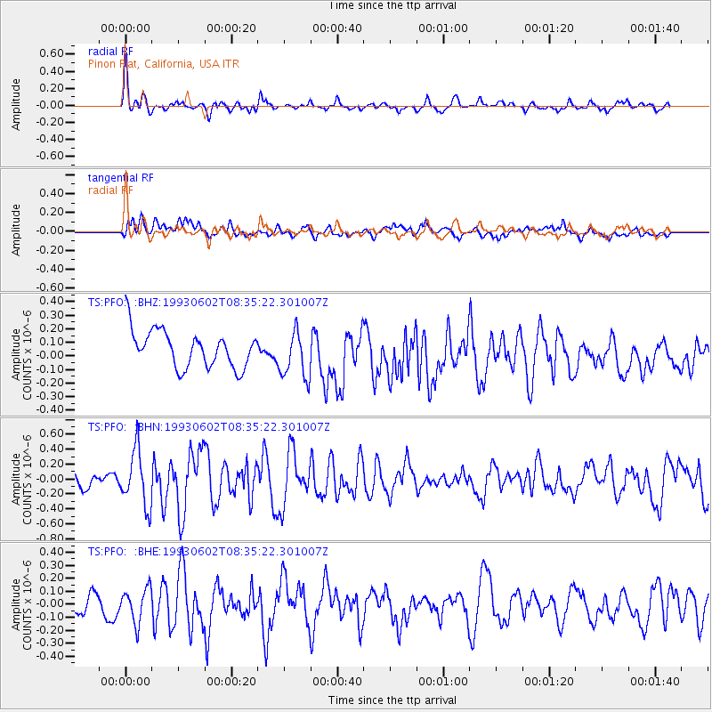
PFO Pinon Flat, California, USA - Earthquake Result Viewer
*The percent match for this event was below the threshold and hence no stack was calculated.
| Earthquake location: |
Andreanof Islands, Aleutian Is. |
| Earthquake latitude/longitude: |
51.5/-178.7 |
| Earthquake time(UTC): |
1993/06/02 (153) 08:27:20 GMT |
| Earthquake Depth: |
48 km |
| Earthquake Magnitude: |
5.6 MB, 5.4 MS, 5.3 UNKNOWN, 5.4 ML |
| Earthquake Catalog/Contributor: |
WHDF/NEIC |
|
| Network: |
TS TERRAscope (Southern California Seismic Network) |
| Station: |
PFO Pinon Flat, California, USA |
| Lat/Lon: |
33.61 N/116.46 W |
| Elevation: |
1280 m |
|
| Distance: |
47.7 deg |
| Az: |
86.821 deg |
| Baz: |
311.628 deg |
| Ray Param: |
$rayparam |
*The percent match for this event was below the threshold and hence was not used in the summary stack. |
|
| Radial Match: |
68.62134 % |
| Radial Bump: |
388 |
| Transverse Match: |
50.005833 % |
| Transverse Bump: |
400 |
| SOD ConfigId: |
4480 |
| Insert Time: |
2010-02-26 14:44:11.522 +0000 |
| GWidth: |
2.5 |
| Max Bumps: |
400 |
| Tol: |
0.001 |
|
Signal To Noise
| Channel | StoN | STA | LTA |
| TS:PFO: :BHN:19930602T08:35:22.301007Z | 3.102585 | 3.7961314E-7 | 1.2235382E-7 |
| TS:PFO: :BHE:19930602T08:35:22.301007Z | 1.2477971 | 1.3226601E-7 | 1.0599961E-7 |
| TS:PFO: :BHZ:19930602T08:35:22.301007Z | 1.3192556 | 1.7943402E-7 | 1.3601156E-7 |
| Arrivals |
| Ps | |
| PpPs | |
| PsPs/PpSs | |


