You are here: Home > Network List > GM - US Geological Survey Networks Stations List
> Station IWM01 Jericho 2M Well Monitoring Station > Earthquake Result Viewer
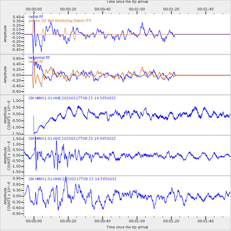
IWM01 Jericho 2M Well Monitoring Station - Earthquake Result Viewer
*The percent match for this event was below the threshold and hence no stack was calculated.
| Earthquake location: |
Near Coast Of Central Chile |
| Earthquake latitude/longitude: |
-36.2/-73.2 |
| Earthquake time(UTC): |
2020/03/17 (077) 08:12:02 GMT |
| Earthquake Depth: |
29 km |
| Earthquake Magnitude: |
5.6 Mww |
| Earthquake Catalog/Contributor: |
NEIC PDE/us |
|
| Network: |
GM US Geological Survey Networks |
| Station: |
IWM01 Jericho 2M Well Monitoring Station |
| Lat/Lon: |
36.73 N/96.53 W |
| Elevation: |
328 m |
|
| Distance: |
75.7 deg |
| Az: |
340.797 deg |
| Baz: |
160.653 deg |
| Ray Param: |
$rayparam |
*The percent match for this event was below the threshold and hence was not used in the summary stack. |
|
| Radial Match: |
57.11626 % |
| Radial Bump: |
400 |
| Transverse Match: |
83.367905 % |
| Transverse Bump: |
400 |
| SOD ConfigId: |
20906531 |
| Insert Time: |
2020-04-08 10:59:52.403 +0000 |
| GWidth: |
2.5 |
| Max Bumps: |
400 |
| Tol: |
0.001 |
|
Signal To Noise
| Channel | StoN | STA | LTA |
| GM:IWM01:01:HHZ:20200317T08:23:14.565003Z | 1.6704375 | 5.905384E-7 | 3.5352318E-7 |
| GM:IWM01:01:HHN:20200317T08:23:14.565003Z | 1.2387882 | 3.2688243E-7 | 2.6387275E-7 |
| GM:IWM01:01:HHE:20200317T08:23:14.565003Z | 0.89092374 | 4.6231267E-7 | 5.1891385E-7 |
| Arrivals |
| Ps | |
| PpPs | |
| PsPs/PpSs | |


