You are here: Home > Network List > US - United States National Seismic Network Stations List
> Station CBKS Cedar Bluff, Kansas, USA > Earthquake Result Viewer
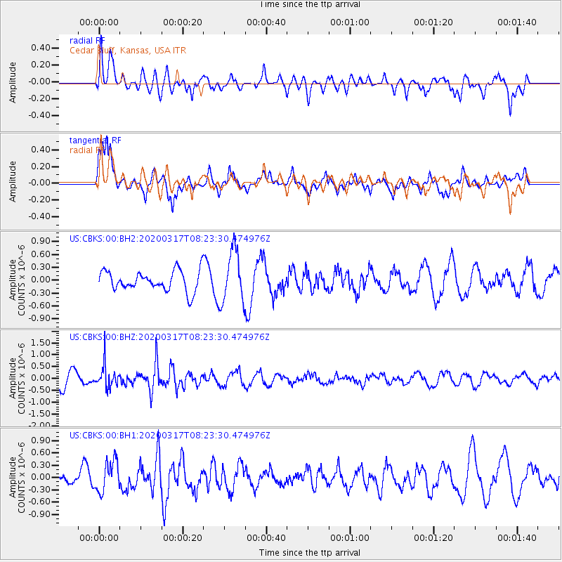
CBKS Cedar Bluff, Kansas, USA - Earthquake Result Viewer
*The percent match for this event was below the threshold and hence no stack was calculated.
| Earthquake location: |
Near Coast Of Central Chile |
| Earthquake latitude/longitude: |
-36.2/-73.2 |
| Earthquake time(UTC): |
2020/03/17 (077) 08:12:02 GMT |
| Earthquake Depth: |
29 km |
| Earthquake Magnitude: |
5.6 Mww |
| Earthquake Catalog/Contributor: |
NEIC PDE/us |
|
| Network: |
US United States National Seismic Network |
| Station: |
CBKS Cedar Bluff, Kansas, USA |
| Lat/Lon: |
38.81 N/99.74 W |
| Elevation: |
677 m |
|
| Distance: |
78.5 deg |
| Az: |
339.106 deg |
| Baz: |
158.32 deg |
| Ray Param: |
$rayparam |
*The percent match for this event was below the threshold and hence was not used in the summary stack. |
|
| Radial Match: |
57.012543 % |
| Radial Bump: |
400 |
| Transverse Match: |
44.520306 % |
| Transverse Bump: |
392 |
| SOD ConfigId: |
20906531 |
| Insert Time: |
2020-04-08 11:09:43.938 +0000 |
| GWidth: |
2.5 |
| Max Bumps: |
400 |
| Tol: |
0.001 |
|
Signal To Noise
| Channel | StoN | STA | LTA |
| US:CBKS:00:BHZ:20200317T08:23:30.474976Z | 1.6679753 | 4.5760856E-7 | 2.7434973E-7 |
| US:CBKS:00:BH1:20200317T08:23:30.474976Z | 2.448472 | 3.7928316E-7 | 1.5490606E-7 |
| US:CBKS:00:BH2:20200317T08:23:30.474976Z | 2.5728652 | 6.004453E-7 | 2.3337611E-7 |
| Arrivals |
| Ps | |
| PpPs | |
| PsPs/PpSs | |


