You are here: Home > Network List > UW - Pacific Northwest Regional Seismic Network Stations List
> Station IRON Crane, OR, USA > Earthquake Result Viewer
IRON Crane, OR, USA - Earthquake Result Viewer
*The percent match for this event was below the threshold and hence no stack was calculated.
| Earthquake location: |
Near Coast Of Central Chile |
| Earthquake latitude/longitude: |
-36.2/-73.2 |
| Earthquake time(UTC): |
2020/03/17 (077) 08:12:02 GMT |
| Earthquake Depth: |
29 km |
| Earthquake Magnitude: |
5.6 Mww |
| Earthquake Catalog/Contributor: |
NEIC PDE/us |
|
| Network: |
UW Pacific Northwest Regional Seismic Network |
| Station: |
IRON Crane, OR, USA |
| Lat/Lon: |
43.36 N/118.47 W |
| Elevation: |
1226 m |
|
| Distance: |
89.2 deg |
| Az: |
328.76 deg |
| Baz: |
144.872 deg |
| Ray Param: |
$rayparam |
*The percent match for this event was below the threshold and hence was not used in the summary stack. |
|
| Radial Match: |
48.22436 % |
| Radial Bump: |
338 |
| Transverse Match: |
63.76618 % |
| Transverse Bump: |
309 |
| SOD ConfigId: |
20906531 |
| Insert Time: |
2020-04-08 11:10:51.313 +0000 |
| GWidth: |
2.5 |
| Max Bumps: |
400 |
| Tol: |
0.001 |
|
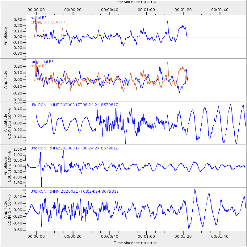
Signal To Noise
| Channel | StoN | STA | LTA |
| UW:IRON: :HHZ:20200317T08:24:24.867981Z | 3.0757613 | 5.51532E-7 | 1.7931562E-7 |
| UW:IRON: :HHN:20200317T08:24:24.867981Z | 1.6008292 | 1.4658075E-7 | 9.156552E-8 |
| UW:IRON: :HHE:20200317T08:24:24.867981Z | 1.245695 | 1.8047191E-7 | 1.448765E-7 |
| Arrivals |
| Ps | |
| PpPs | |
| PsPs/PpSs | |


