You are here: Home > Network List > TS - TERRAscope (Southern California Seismic Network) Stations List
> Station PFO Pinon Flat, California, USA > Earthquake Result Viewer
PFO Pinon Flat, California, USA - Earthquake Result Viewer
*The percent match for this event was below the threshold and hence no stack was calculated.
| Earthquake location: |
Mariana Islands |
| Earthquake latitude/longitude: |
18.9/145.0 |
| Earthquake time(UTC): |
1995/08/24 (236) 07:54:41 GMT |
| Earthquake Depth: |
598 km |
| Earthquake Magnitude: |
5.3 MB, 6.1 UNKNOWN |
| Earthquake Catalog/Contributor: |
WHDF/NEIC |
|
| Network: |
TS TERRAscope (Southern California Seismic Network) |
| Station: |
PFO Pinon Flat, California, USA |
| Lat/Lon: |
33.61 N/116.46 W |
| Elevation: |
1280 m |
|
| Distance: |
86.6 deg |
| Az: |
55.761 deg |
| Baz: |
290.268 deg |
| Ray Param: |
$rayparam |
*The percent match for this event was below the threshold and hence was not used in the summary stack. |
|
| Radial Match: |
59.334267 % |
| Radial Bump: |
400 |
| Transverse Match: |
63.4149 % |
| Transverse Bump: |
400 |
| SOD ConfigId: |
4480 |
| Insert Time: |
2010-02-26 14:44:15.601 +0000 |
| GWidth: |
2.5 |
| Max Bumps: |
400 |
| Tol: |
0.001 |
|
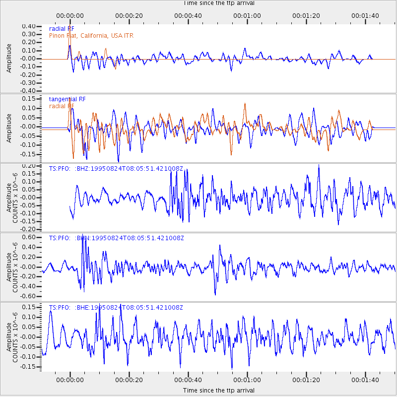
Signal To Noise
| Channel | StoN | STA | LTA |
| TS:PFO: :BHN:19950824T08:05:51.421008Z | 3.5291026 | 2.2893296E-7 | 6.487002E-8 |
| TS:PFO: :BHE:19950824T08:05:51.421008Z | 0.5666621 | 3.2517562E-8 | 5.7384398E-8 |
| TS:PFO: :BHZ:19950824T08:05:51.421008Z | 1.5595634 | 6.005197E-8 | 3.8505625E-8 |
| Arrivals |
| Ps | |
| PpPs | |
| PsPs/PpSs | |


