You are here: Home > Network List > WY - Yellowstone Wyoming Seismic Network Stations List
> Station YHH Holmes Hill, YNP, WY, USA > Earthquake Result Viewer
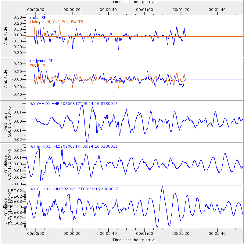
YHH Holmes Hill, YNP, WY, USA - Earthquake Result Viewer
*The percent match for this event was below the threshold and hence no stack was calculated.
| Earthquake location: |
Near Coast Of Central Chile |
| Earthquake latitude/longitude: |
-36.2/-73.2 |
| Earthquake time(UTC): |
2020/03/17 (077) 08:12:02 GMT |
| Earthquake Depth: |
29 km |
| Earthquake Magnitude: |
5.6 Mww |
| Earthquake Catalog/Contributor: |
NEIC PDE/us |
|
| Network: |
WY Yellowstone Wyoming Seismic Network |
| Station: |
YHH Holmes Hill, YNP, WY, USA |
| Lat/Lon: |
44.79 N/110.85 W |
| Elevation: |
2717 m |
|
| Distance: |
87.5 deg |
| Az: |
334.165 deg |
| Baz: |
150.314 deg |
| Ray Param: |
$rayparam |
*The percent match for this event was below the threshold and hence was not used in the summary stack. |
|
| Radial Match: |
67.32577 % |
| Radial Bump: |
376 |
| Transverse Match: |
58.007256 % |
| Transverse Bump: |
355 |
| SOD ConfigId: |
20906531 |
| Insert Time: |
2020-04-08 11:11:43.464 +0000 |
| GWidth: |
2.5 |
| Max Bumps: |
400 |
| Tol: |
0.001 |
|
Signal To Noise
| Channel | StoN | STA | LTA |
| WY:YHH:01:HHZ:20200317T08:24:16.638001Z | 2.619943 | 1.6905954E-8 | 6.4527943E-9 |
| WY:YHH:01:HHN:20200317T08:24:16.638001Z | 1.8671368 | 7.3302897E-9 | 3.925952E-9 |
| WY:YHH:01:HHE:20200317T08:24:16.638001Z | 2.2933612 | 1.04802504E-8 | 4.5698214E-9 |
| Arrivals |
| Ps | |
| PpPs | |
| PsPs/PpSs | |


