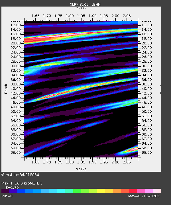
S102 Oregon Trail, WY - Earthquake Result Viewer
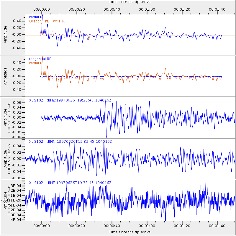
Earthquake location: Southern East Pacific Rise
Earthquake latitude/longitude: -49.7/-114.6
Earthquake time(UTC): 1997/06/26 (177) 19:21:08 GMT
Earthquake Depth: 10 km
Earthquake Magnitude: 5.4 MB, 6.0 MS, 6.2 UNKNOWN, 6.1 MW
Earthquake Catalog/Contributor: WHDF/NEIC
Network: XL Deep Probe (Archean-Proterozoic)
Station: S102 Oregon Trail, WY
Lat/Lon: 42.34 N/108.94 W
Elevation: 2212 m
Distance: 91.8 deg
Az: 4.176 deg
Baz: 183.657 deg
Ray Param: 0.041556817
Estimated Moho Depth: 16.0 km
Estimated Crust Vp/Vs: 1.79
Assumed Crust Vp: 6.161 km/s
Estimated Crust Vs: 3.442 km/s
Estimated Crust Poisson's Ratio: 0.27
Radial Match: 86.218956 %
Radial Bump: 400
Transverse Match: 85.17664 %
Transverse Bump: 400
SOD ConfigId: 6273
Insert Time: 2010-03-08 18:17:38.074 +0000
GWidth: 2.5
Max Bumps: 400
Tol: 0.001

Signal To Noise

ChannelStoNSTALTA
XL:S102: :BHN:19970626T19:33:45.104016Z1.00787196.716964E-96.664502E-9
XL:S102: :BHE:19970626T19:33:45.104016Z1.20009181.3159443E-101.0965363E-10
XL:S102: :BHZ:19970626T19:33:45.104016Z2.07271151.1063305E-85.3376006E-9
Arrivals
Ps2.1 SECOND
PpPs7.1 SECOND
PsPs/PpSs9.2 SECOND